Mīnūdasht geodata
Mīnūdasht (Golestan) is a seat of a second-order administrative division; located in Iran in Asia/Tehran (GMT+3.5) time zone. In our database, there are 232 cities with bigger population. Compared to other cities in Iran, 87.3% of cities are located further ↓South; 78.2% of cities are located further ←West and 79.8% of cities have higher elevation than Mīnūdasht. Note1


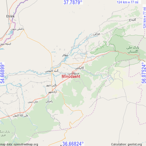
Mīnūdasht GPS coordinates[2]
37° 13' 48.54" North, 55° 22' 19.596" East
| Map corner | latitude | longitude |
|---|---|---|
| Upper-left | 37.7879°, | 54.66899° |
| Center: | 37.23015°, | 55.37211° |
| Lower-right: | 36.66824°, | 56.07524° |
| Map W x H: | 124.5×124.5 km | = 77.4×77.4mi |
| max Lat: | 39.6482° ⇑12.7% North |
| Mīnūdasht: | 37.23015° |
| min Lat: | ⇓87.3% South 25.2919° |
| min Long | Mīnūdasht | max Long |
| 44.38416° | 55.37211° | 61.9965° |
| W 78.2%⇐ | ⇒21.8% E |
Elevation
Elevation of Mīnūdasht is 156 m = 512 ft, and this is 893 m = 2930 ft below average elevation for this country.
| Max E: |
2564 m = 8412 ft | 79.8% |
| Avg. | 1049 m = 3442 ft | |
| Mīnūdasht | 156 m = 512 ft | |
Min E: |
-24 m = -79 ft | 20.2% |
See also: Iran elevation on elevation.city.
Geographical zone
Mīnūdasht is located in North temperate zone (between Tropic of Cancer and the Arctic Circle). Distance of this Northern Tropic circle is 1533.7 km =953 mi to South.| Distance of | km | miles | from Mīnūdasht |
|---|---|---|---|
| North Pole | 5867.5 | 3645.9 | to North |
| Arctic Circle | 3261.6 | 2026.7 | to North |
| Tropic Cancer | 1533.7 | 953 | to South |
| Equator | 4139.6 | 2572.2 | to South |


Nearby cities:
15 places around Mīnūdasht: (largest is in red/bold)
• Aliabad-e Katul
57.2 km =35.5 mi,  231°
231°
• Garmeh
85.7 km =53.3 mi,  108°
108°
• Gomīshān
116.2 km =72.2 mi,  261°
261°
• Gonbad-e Kāvūs
18.3 km =11.4 mi,  276°
276°
• Gorgān
93 km =57.8 mi,  242°
242°
• Gālīkesh
7.2 km =4.5 mi,  49°
49°
• Jājarm
94.7 km =58.8 mi, 109°
• Kalāleh
19.7 km =12.2 mi,  32°
32°
• Marāveh Tappeh
90.9 km =56.5 mi, 34°
• Qarnābād
82.8 km =51.4 mi, 236°
• Rāmīān
31.4 km =19.5 mi,  220°
220°
• Shahrud
96.9 km =60.2 mi,  201°
201°
• Āq Qalā
84.8 km =52.7 mi,  253°
253°
• Āq Qāyeh
19.5 km =12.1 mi, 284°
• Āzādshahr
23.9 km =14.9 mi, 227°
Sources, notices
• [Note1] Compared only with cities in Iran existing in our database
• [Src1] Map data: © OpenStreetMap contributors (CC-BY-SA)
• [Src2] Other city data from geonames.org with taken over terms of usage.
• [Src3] Geographical zone / Annual Mean Temperature by Robert A. Rohde @ Wikipedia
