Gonbad-e Kāvūs geodata
Gonbad-e Kāvūs (Golestan) is a seat of a second-order administrative division; located in Iran in Asia/Tehran (GMT+3.5) time zone. With population of 131,416 people, there are 54 cities with bigger population in this country. Compared to other cities in Iran, 87.8% of cities are located further ↓South; 77.6% of cities are located further ←West and 86.2% of cities have higher elevation than Gonbad-e Kāvūs. Note1


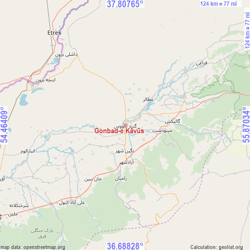
Gonbad-e Kāvūs GPS coordinates[2]
37° 15' 0.144" North, 55° 10' 1.956" East
| Map corner | latitude | longitude |
|---|---|---|
| Upper-left | 37.80765°, | 54.46409° |
| Center: | 37.25004°, | 55.16721° |
| Lower-right: | 36.68828°, | 55.87034° |
| Map W x H: | 124.5×124.5 km | = 77.4×77.4mi |
| max Lat: | 39.6482° ⇑12.2% North |
| Gonbad-e Kāvūs: | 37.25004° |
| min Lat: | ⇓87.8% South 25.2919° |
| min Long | Gonbad-e Kāvū | max Long |
| 44.38416° | 55.16721° | 61.9965° |
| W 77.6%⇐ | ⇒22.4% E |
Elevation
Elevation of Gonbad-e Kāvūs is 38 m = 125 ft, and this is 1011 m = 3317 ft below average elevation for this country.
| Max E: |
2564 m = 8412 ft | 86.2% |
| Avg. | 1049 m = 3442 ft | |
| Gonbad-e Kāvūs | 38 m = 125 ft | |
Min E: |
-24 m = -79 ft | 13.8% |
See also: Gonbad-e Kāvūs elevation on elevation.city.
Geographical zone
Gonbad-e Kāvūs is located in North temperate zone (between Tropic of Cancer and the Arctic Circle). Distance of this Northern Tropic circle is 1535.9 km =954.4 mi to South.| Distance of | km | miles | from Gonbad-e Kāvūs |
|---|---|---|---|
| North Pole | 5865.2 | 3644.5 | to North |
| Arctic Circle | 3259.4 | 2025.3 | to North |
| Tropic Cancer | 1535.9 | 954.4 | to South |
| Equator | 4141.8 | 2573.6 | to South |


Nearby cities:
15 places around Gonbad-e Kāvūs: (largest is in red/bold)
• Aliabad-e Katul
46.2 km =28.7 mi,  215°
215°
• Bandar-e Torkaman
104.6 km =65 mi,  248°
248°
• Garmeh
103.7 km =64.4 mi,  106°
106°
• Gomīshān
98.7 km =61.3 mi,  258°
258°
• Gorgān
78.6 km =48.8 mi,  234°
234°
• Gālīkesh
23.7 km =14.7 mi,  83°
83°
• Kalāleh
32.2 km =20 mi,  63°
63°
• Marāveh Tappeh
100.6 km =62.5 mi,  43°
43°
• Mīnūdasht
18.3 km =11.4 mi,  96°
96°
• Qarnābād
69.8 km =43.4 mi, 227°
• Rāmīān
26.1 km =16.2 mi,  185°
185°
• Shahrud
94 km =58.4 mi, 190°
• Āq Qalā
68.4 km =42.5 mi, 247°
• Āq Qāyeh
2.8 km =1.7 mi,  344°
344°
• Āzādshahr
18.2 km =11.3 mi,  178°
178°
Sources, notices
• [Note1] Compared only with cities in Iran existing in our database
• [Src1] Map data: © OpenStreetMap contributors (CC-BY-SA)
• [Src2] Other city data from geonames.org with taken over terms of usage.
• [Src3] Geographical zone / Annual Mean Temperature by Robert A. Rohde @ Wikipedia
