Orūmīyeh geodata
Orūmīyeh (West Azerbaijan) is a seat of a first-order administrative division; located in Iran in Asia/Tehran (GMT+3.5) time zone. With population of 577,307 people, there are 13 cities with bigger population in this country. Compared to other cities in Iran, 92.1% of cities are located further ↓South; 98.4% of cities are located further →East and 61.2% of cities have lower elevation than Orūmīyeh. Note1


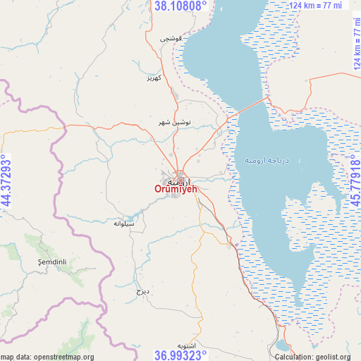
Orūmīyeh GPS coordinates[2]
37° 33' 9.864" North, 45° 4' 33.78" East
| Map corner | latitude | longitude |
|---|---|---|
| Upper-left | 38.10808°, | 44.37293° |
| Center: | 37.55274°, | 45.07605° |
| Lower-right: | 36.99323°, | 45.77918° |
| Map W x H: | 124×124 km | = 77.1×77.1mi |
| max Lat: | 39.6482° ⇑7.9% North |
| Orūmīyeh: | 37.55274° |
| min Lat: | ⇓92.1% South 25.2919° |
| min Long | Orūmīyeh | max Long |
| 44.38416° | 45.07605° | 61.9965° |
| W 1.6%⇐ | ⇒98.4% E |
Elevation
Elevation of Orūmīyeh is 1350 m = 4429 ft, and this is 301 m = 988 ft above average elevation for this country.
| Max E: |
2564 m = 8412 ft | 38.8% |
| Orūmīyeh | 1350 m 4429 ft | |
| Avg. | 1049 m = 3442 ft | |
Min E: |
-24 m = -79 ft | 61.2% |
See also: Orūmīyeh elevation on elevation.city.
Geographical zone
Orūmīyeh is located in North temperate zone (between Tropic of Cancer and the Arctic Circle). Distance of this Northern Tropic circle is 1569.6 km =975.3 mi to South.| Distance of | km | miles | from Orūmīyeh |
|---|---|---|---|
| North Pole | 5831.6 | 3623.6 | to North |
| Arctic Circle | 3225.7 | 2004.4 | to North |
| Tropic Cancer | 1569.6 | 975.3 | to South |
| Equator | 4175.5 | 2594.5 | to South |


Nearby cities:
15 places around Orūmīyeh: (largest is in red/bold)
• Bonāb
89.7 km =55.7 mi,  105°
105°
• Kandovān
106.7 km =66.3 mi,  75°
75°
• Khowy
111.4 km =69.2 mi,  354°
354°
• Mahābād
104.8 km =65.1 mi,  146°
146°
• Malekān
101.6 km =63.1 mi,  116°
116°
• Marāgheh
104.2 km =64.7 mi,  99°
99°
• Mīāndoāb
112.3 km =69.8 mi,  125°
125°
• Naqadeh
71.9 km =44.7 mi,  157°
157°
• Oshnavīyeh
57.1 km =35.5 mi,  178°
178°
• Oskū
100.5 km =62.4 mi,  66°
66°
• Piranshahr
94.9 km =59 mi, 176°
• Salmās
76.7 km =47.7 mi,  339°
339°
• Shabestar
88.9 km =55.2 mi,  38°
38°
• Āz̄arshahr
82.7 km =51.4 mi, 73°
• ‘Ajab Shīr
72.6 km =45.1 mi, 96°
Sources, notices
• [Note1] Compared only with cities in Iran existing in our database
• [Src1] Map data: © OpenStreetMap contributors (CC-BY-SA)
• [Src2] Other city data from geonames.org with taken over terms of usage.
• [Src3] Geographical zone / Annual Mean Temperature by Robert A. Rohde @ Wikipedia
