Khomārlū geodata
Khomārlū (East Azerbaijan) is a seat of a second-order administrative division; located in Iran in Asia/Tehran (GMT+3.5) time zone. In our database, there are 232 cities with bigger population. Compared to other cities in Iran, 98.9% of cities are located further ↓South; 88.4% of cities are located further →East and 75.7% of cities have higher elevation than Khomārlū. Note1


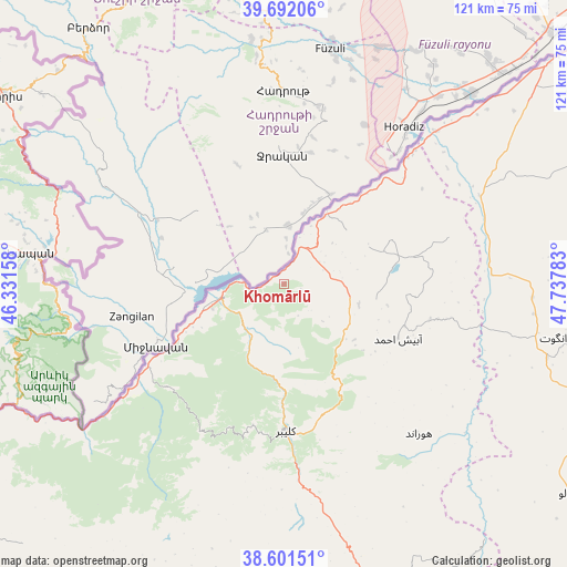
Khomārlū GPS coordinates[2]
39° 8' 56.04" North, 47° 2' 4.92" East
| Map corner | latitude | longitude |
|---|---|---|
| Upper-left | 39.69206°, | 46.33158° |
| Center: | 39.1489°, | 47.0347° |
| Lower-right: | 38.60151°, | 47.73783° |
| Map W x H: | 121.3×121.3 km | = 75.4×75.4mi |
| max Lat: | 39.6482° ⇑1.1% North |
| Khomārlū: | 39.1489° |
| min Lat: | ⇓98.9% South 25.2919° |
| min Long | Khomārlū | max Long |
| 44.38416° | 47.0347° | 61.9965° |
| W 11.6%⇐ | ⇒88.4% E |
Elevation
Elevation of Khomārlū is 391 m = 1283 ft, and this is 658 m = 2159 ft below average elevation for this country.
| Max E: |
2564 m = 8412 ft | 75.7% |
| Avg. | 1049 m = 3442 ft | |
| Khomārlū | 391 m = 1283 ft | |
Min E: |
-24 m = -79 ft | 24.3% |
See also: Iran elevation on elevation.city.
Geographical zone
Khomārlū is located in North temperate zone (between Tropic of Cancer and the Arctic Circle). Distance of this Northern Tropic circle is 1747 km =1085.5 mi to South.| Distance of | km | miles | from Khomārlū |
|---|---|---|---|
| North Pole | 5654.1 | 3513.3 | to North |
| Arctic Circle | 3048.2 | 1894.1 | to North |
| Tropic Cancer | 1747 | 1085.5 | to South |
| Equator | 4352.9 | 2704.8 | to South |


Nearby cities:
15 places around Khomārlū: (largest is in red/bold)
• Ahar
74.7 km =46.4 mi,  177°
177°
• Ardabīl
148.1 km =92 mi,  132°
132°
• Bostānābād
145.9 km =90.7 mi,  186°
186°
• Bīleh Savār
116.5 km =72.4 mi,  77°
77°
• Germī
91.3 km =56.7 mi,  98°
98°
• Herīs
100.4 km =62.4 mi, 175°
• Kaleybar
31.6 km =19.6 mi, 179°
• Marand
135.1 km =83.9 mi,  233°
233°
• Meshgīn Shahr
100.5 km =62.4 mi,  146°
146°
• Mīāb
117.7 km =73.1 mi,  244°
244°
• Omīdcheh
135.7 km =84.3 mi, 134°
• Pārsābād
94 km =58.4 mi,  53°
53°
• Sarāb
141.2 km =87.7 mi,  161°
161°
• Tabriz
135.2 km =84 mi,  208°
208°
• Varazqān
95.6 km =59.4 mi, 236°
Sources, notices
• [Note1] Compared only with cities in Iran existing in our database
• [Src1] Map data: © OpenStreetMap contributors (CC-BY-SA)
• [Src2] Other city data from geonames.org with taken over terms of usage.
• [Src3] Geographical zone / Annual Mean Temperature by Robert A. Rohde @ Wikipedia
