Pārsābād geodata
Pārsābād (Ardabīl) is a seat of a second-order administrative division; located in Iran in Asia/Tehran (GMT+3.5) time zone. With population of 101,661 people, there are 65 cities with bigger population in this country. Compared to other cities in Iran, 100% of cities are located further ↓South; 83% of cities are located further →East and 84.8% of cities have higher elevation than Pārsābād. Note1


Pārsābād GPS coordinates[2]
39° 38' 53.52" North, 47° 55' 2.64" East
| Map corner | latitude | longitude |
|---|---|---|
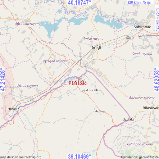
| Upper-left | 40.18747°, | 47.21428° |
| Center: | 39.6482°, | 47.9174° |
| Lower-right: | 39.10469°, | 48.62053° |
| Map W x H: | 120.4×120.4 km | = 74.8×74.8mi |
| max Lat: | 39.6482° ⇑0% North |
| Pārsābād: | 39.6482° |
| min Lat: | ⇓100% South 25.2919° |
| min Long | Pārsābād | max Long |
| 44.38416° | 47.9174° | 61.9965° |
| W 17%⇐ | ⇒83% E |
Elevation
Elevation of Pārsābād is 46 m = 151 ft, and this is 1003 m = 3291 ft below average elevation for this country.
| Max E: |
2564 m = 8412 ft | 84.8% |
| Avg. | 1049 m = 3442 ft | |
| Pārsābād | 46 m = 151 ft | |
Min E: |
-24 m = -79 ft | 15.2% |
See also: Pārsābād elevation on elevation.city.
Geographical zone
Pārsābād is located in North temperate zone (between Tropic of Cancer and the Arctic Circle). Distance of this Northern Tropic circle is 1802.5 km =1120 mi to South.| Distance of | km | miles | from Pārsābād |
|---|---|---|---|
| North Pole | 5598.6 | 3478.8 | to North |
| Arctic Circle | 2992.7 | 1859.6 | to North |
| Tropic Cancer | 1802.5 | 1120 | to South |
| Equator | 4408.5 | 2739.3 | to South |


Nearby cities:
15 places around Pārsābād: (largest is in red/bold)
• Ahar
149.3 km =92.8 mi,  209°
209°
• Ardabīl
158.8 km =98.7 mi,  168°
168°
• Bīleh Savār
47.9 km =29.8 mi,  128°
128°
• Germī
71.1 km =44.2 mi, 168°
• Herīs
170.4 km =105.9 mi,  203°
203°
• Kaleybar
115.3 km =71.6 mi,  220°
220°
• Khomārlū
94 km =58.4 mi,  233°
233°
• Meshgīn Shahr
140.4 km =87.2 mi,  188°
188°
• Mīāb
210.6 km =130.9 mi,  239°
239°
• Namīn
144.3 km =89.7 mi,  160°
160°
• Nīr
179.6 km =111.6 mi,  177°
177°
• Omīdcheh
152.6 km =94.8 mi, 172°
• Sarāb
192.7 km =119.7 mi, 189°
• Varazqān
189.5 km =117.7 mi, 235°
• Āstārā
158.7 km =98.6 mi,  148°
148°
Sources, notices
• [Note1] Compared only with cities in Iran existing in our database
• [Src1] Map data: © OpenStreetMap contributors (CC-BY-SA)
• [Src2] Other city data from geonames.org with taken over terms of usage.
• [Src3] Geographical zone / Annual Mean Temperature by Robert A. Rohde @ Wikipedia
