Behbahān geodata
Behbahān (Khuzestan) is a seat of a second-order administrative division; located in Iran in Asia/Tehran (GMT+3.5) time zone. With population of 79,327 people, there are 85 cities with bigger population in this country. Compared to other cities in Iran, 79.1% of cities are located further ↑North; 60.1% of cities are located further →East and 77.1% of cities have higher elevation than Behbahān. Note1


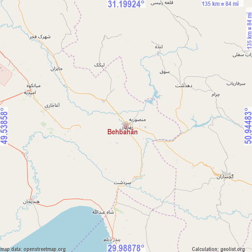
Behbahān GPS coordinates[2]
30° 35' 45.24" North, 50° 14' 30.12" East
| Map corner | latitude | longitude |
|---|---|---|
| Upper-left | 31.19924°, | 49.53858° |
| Center: | 30.5959°, | 50.2417° |
| Lower-right: | 29.98878°, | 50.94483° |
| Map W x H: | 134.6×134.6 km | = 83.6×83.6mi |
| max Lat: | 39.6482° ⇑79.1% North |
| Behbahān: | 30.5959° |
| min Lat: | ⇓20.9% South 25.2919° |
| min Long | Behbahān | max Long |
| 44.38416° | 50.2417° | 61.9965° |
| W 39.9%⇐ | ⇒60.1% E |
Elevation
Elevation of Behbahān is 326 m = 1070 ft, and this is 723 m = 2372 ft below average elevation for this country.
| Max E: |
2564 m = 8412 ft | 77.1% |
| Avg. | 1049 m = 3442 ft | |
| Behbahān | 326 m = 1070 ft | |
Min E: |
-24 m = -79 ft | 22.9% |
See also: Behbahān elevation on elevation.city.
Geographical zone
Behbahān is located in North temperate zone (between Tropic of Cancer and the Arctic Circle). Distance of this Northern Tropic circle is 796 km =494.6 mi to South.| Distance of | km | miles | from Behbahān |
|---|---|---|---|
| North Pole | 6605.1 | 4104.2 | to North |
| Arctic Circle | 3999.2 | 2485 | to North |
| Tropic Cancer | 796 | 494.6 | to South |
| Equator | 3401.9 | 2113.8 | to South |


Nearby cities:
15 places around Behbahān: (largest is in red/bold)
• Aghajari
40.9 km =25.4 mi,  286°
286°
• Bandar-e Deylam
60.8 km =37.8 mi,  187°
187°
• Bandar-e Emam Khomeyni
110.5 km =68.7 mi,  260°
260°
• Bandar-e Genāveh
116.1 km =72.1 mi,  166°
166°
• Bandar-e Māhshahr
100.9 km =62.7 mi,  267°
267°
• Bāgh-e Malek
108.6 km =67.5 mi,  341°
341°
• Bāsht
91.5 km =56.9 mi,  106°
106°
• Dehdasht
38 km =23.6 mi,  54°
54°
• Dogonbadan
59.5 km =37 mi,  116°
116°
• Hendījān
64.6 km =40.1 mi,  231°
231°
• Lordegān
116.2 km =72.2 mi,  28°
28°
• Līkak
36.2 km =22.5 mi, 336°
• Omīdīyeh
54.8 km =34.1 mi, 289°
• Rāmhormoz
97.4 km =60.5 mi,  321°
321°
• Rāmshīr
86.3 km =53.6 mi, 292°
Sources, notices
• [Note1] Compared only with cities in Iran existing in our database
• [Src1] Map data: © OpenStreetMap contributors (CC-BY-SA)
• [Src2] Other city data from geonames.org with taken over terms of usage.
• [Src3] Geographical zone / Annual Mean Temperature by Robert A. Rohde @ Wikipedia
