Bandar-e Emam Khomeyni geodata
Bandar-e Emam Khomeyni (Khuzestan) is a seat of a third-order administrative division; located in Iran in Asia/Tehran (GMT+3.5) time zone. In our database, there are 232 cities with bigger population. Compared to other cities in Iran, 80% of cities are located further ↑North; 70.7% of cities are located further →East and 95.2% of cities have higher elevation than Bandar-e Emam Khomeyni. Note1
Current local time in Bandar-e Emam Khomeyni:
02:13 PM, TuesdayDifference from your time zone: hours


Bandar-e Emam Khomeyni GPS coordinates[2]
30° 26' 13.128" North, 49° 6' 10.368" East
| Map corner | latitude | longitude |
|---|---|---|
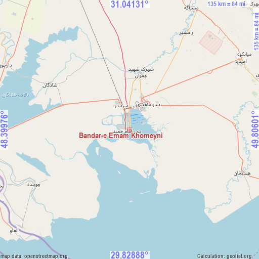
| Upper-left | 31.04131°, | 48.39976° |
| Center: | 30.43698°, | 49.10288° |
| Lower-right: | 29.82888°, | 49.80601° |
| Map W x H: | 134.8×134.8 km | = 83.8×83.8mi |
| max Lat: | 39.6482° ⇑80% North |
| Bandar-e Emam Khomeyni: | 30.43698° |
| min Lat: | ⇓20% South 25.2919° |
| min Long | Bandar-e Emam K | max Long |
| 44.38416° | 49.10288° | 61.9965° |
| W 29.3%⇐ | ⇒70.7% E |
Elevation
Elevation of Bandar-e Emam Khomeyni is 3 m = 10 ft, and this is 1046 m = 3432 ft below average elevation for this country.
| Max E: |
2564 m = 8412 ft | 95.2% |
| Avg. | 1049 m = 3442 ft | |
| Bandar-e Emam Khomeyni | 3 m = 10 ft | |
Min E: |
-24 m = -79 ft | 4.8% |
See also: Iran elevation on elevation.city.
Geographical zone
Bandar-e Emam Khomeyni is located in North temperate zone (between Tropic of Cancer and the Arctic Circle). Distance of this Northern Tropic circle is 778.4 km =483.7 mi to South.| Distance of | km | miles | from Bandar-e Emam Khomeyni |
|---|---|---|---|
| North Pole | 6622.8 | 4115.2 | to North |
| Arctic Circle | 4016.9 | 2496 | to North |
| Tropic Cancer | 778.4 | 483.7 | to South |
| Equator | 3384.3 | 2102.9 | to South |


Nearby cities:
15 places around Bandar-e Emam Khomeyni: (largest is in red/bold)
• Abadan
77.4 km =48.1 mi,  261°
261°
• Aghajari
75.7 km =47 mi,  67°
67°
• Ahvaz
105.9 km =65.8 mi,  337°
337°
• Bandar-e Deylam
110 km =68.4 mi,  112°
112°
• Bandar-e Māhshahr
15.6 km =9.7 mi,  31°
31°
• Behbahān
110.5 km =68.7 mi,  80°
80°
• Hendījān
62.6 km =38.9 mi, 110°
• Jongīyeh
102.2 km =63.5 mi,  332°
332°
• Khorramshahr
88.1 km =54.7 mi,  270°
270°
• Līkak
107.5 km =66.8 mi,  61°
61°
• Omīdīyeh
67.8 km =42.1 mi, 57°
• Rāmhormoz
105.2 km =65.4 mi, 27°
• Rāmshīr
58.5 km =36.4 mi, 29°
• Shādegān
48.1 km =29.9 mi,  299°
299°
• sedeyen-e Yek
106.4 km =66.1 mi,  345°
345°
In other languages:
- In Spanish: Bandar Jomeiny
- In German: Bandar-e Imam Chomeini
- In Russian: Бендер-Хомейни
- In Chinese: 霍梅尼港
Sources, notices
• [Note1] Compared only with cities in Iran existing in our database
• [Src1] Map data: © OpenStreetMap contributors (CC-BY-SA)
• [Src2] Other city data from geonames.org with taken over terms of usage.
• [Src3] Geographical zone / Annual Mean Temperature by Robert A. Rohde @ Wikipedia
