Bāsht geodata
Bāsht (Kohgiluyeh and Boyer-Ahmad) is a seat of a second-order administrative division; located in Iran in Asia/Tehran (GMT+3.5) time zone. In our database, there are 232 cities with bigger population. Compared to other cities in Iran, 80.5% of cities are located further ↑North; 51.2% of cities are located further →East and 66.4% of cities have higher elevation than Bāsht. Note1


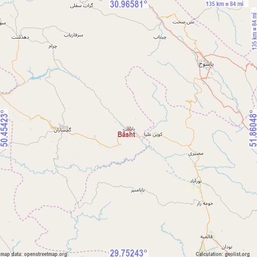
Bāsht GPS coordinates[2]
30° 21' 39.6" North, 51° 9' 26.46" East
| Map corner | latitude | longitude |
|---|---|---|
| Upper-left | 30.96581°, | 50.45423° |
| Center: | 30.361°, | 51.15735° |
| Lower-right: | 29.75243°, | 51.86048° |
| Map W x H: | 134.9×134.9 km | = 83.8×83.8mi |
| max Lat: | 39.6482° ⇑80.5% North |
| Bāsht: | 30.361° |
| min Lat: | ⇓19.5% South 25.2919° |
| min Long | Bāsht | max Long |
| 44.38416° | 51.15735° | 61.9965° |
| W 48.8%⇐ | ⇒51.2% E |
Elevation
Elevation of Bāsht is 807 m = 2648 ft, and this is 242 m = 794 ft below average elevation for this country.
| Max E: |
2564 m = 8412 ft | 66.4% |
| Avg. | 1049 m = 3442 ft | |
| Bāsht | 807 m = 2648 ft | |
Min E: |
-24 m = -79 ft | 33.6% |
See also: Iran elevation on elevation.city.
Geographical zone
Bāsht is located in North temperate zone (between Tropic of Cancer and the Arctic Circle). Distance of this Northern Tropic circle is 769.9 km =478.4 mi to South.| Distance of | km | miles | from Bāsht |
|---|---|---|---|
| North Pole | 6631.2 | 4120.4 | to North |
| Arctic Circle | 4025.3 | 2501.2 | to North |
| Tropic Cancer | 769.9 | 478.4 | to South |
| Equator | 3375.8 | 2097.6 | to South |


Nearby cities:
15 places around Bāsht: (largest is in red/bold)
• Bandar-e Deylam
101.8 km =63.3 mi,  250°
250°
• Bandar-e Genāveh
106.6 km =66.2 mi,  215°
215°
• Behbahān
91.5 km =56.9 mi,  286°
286°
• Borāzjān
121.5 km =75.5 mi,  177°
177°
• Dehdasht
74.5 km =46.3 mi,  310°
310°
• Dogonbadan
34.5 km =21.4 mi,  269°
269°
• Kāzerūn
95.3 km =59.2 mi,  149°
149°
• Lordegān
132 km =82 mi,  346°
346°
• Līkak
117.9 km =73.3 mi,  300°
300°
• Maşīrī
37.3 km =23.2 mi,  110°
110°
• Nūrābād
44.5 km =27.7 mi,  128°
128°
• Semīrom
123.7 km =76.9 mi,  18°
18°
• Sepīdān
80.2 km =49.8 mi,  98°
98°
• Sīsakht
62.8 km =39 mi,  27°
27°
• Yasuj
53.6 km =33.3 mi,  50°
50°
Sources, notices
• [Note1] Compared only with cities in Iran existing in our database
• [Src1] Map data: © OpenStreetMap contributors (CC-BY-SA)
• [Src2] Other city data from geonames.org with taken over terms of usage.
• [Src3] Geographical zone / Annual Mean Temperature by Robert A. Rohde @ Wikipedia
