Alvand geodata
Alvand (Zanjan) is a populated place; located in Iran in Asia/Tehran (GMT+3.5) time zone. With population of 74,889 people, there are 89 cities with bigger population in this country. Compared to other cities in Iran, 72.6% of cities are located further ↓South; 70.1% of cities are located further →East and 88.4% of cities have lower elevation than Alvand. Note1


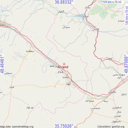
Alvand GPS coordinates[2]
36° 19' 7.86" North, 49° 10' 3.828" East
| Map corner | latitude | longitude |
|---|---|---|
| Upper-left | 36.88332°, | 48.46461° |
| Center: | 36.31885°, | 49.16773° |
| Lower-right: | 35.75026°, | 49.87086° |
| Map W x H: | 126×126 km | = 78.3×78.3mi |
| max Lat: | 39.6482° ⇑27.4% North |
| Alvand: | 36.31885° |
| min Lat: | ⇓72.6% South 25.2919° |
| min Long | Alvand | max Long |
| 44.38416° | 49.16773° | 61.9965° |
| W 29.9%⇐ | ⇒70.1% E |
Elevation
Elevation of Alvand is 1836 m = 6024 ft, and this is 787 m = 2582 ft above average elevation for this country.
| Max E: |
2564 m = 8412 ft | 11.6% |
| Alvand | 1836 m 6024 ft | |
| Avg. | 1049 m = 3442 ft | |
Min E: |
-24 m = -79 ft | 88.4% |
See also: Alvand elevation on elevation.city.
Geographical zone
Alvand is located in North temperate zone (between Tropic of Cancer and the Arctic Circle). Distance of this Northern Tropic circle is 1432.4 km =890.1 mi to South.| Distance of | km | miles | from Alvand |
|---|---|---|---|
| North Pole | 5968.8 | 3708.8 | to North |
| Arctic Circle | 3362.9 | 2089.6 | to North |
| Tropic Cancer | 1432.4 | 890.1 | to South |
| Equator | 4038.3 | 2509.3 | to South |


Nearby cities:
15 places around Alvand: (largest is in red/bold)
• Abhar
19.7 km =12.2 mi,  166°
166°
• Alvand
81.7 km =50.8 mi,  100°
100°
• Bū’īn Zahrā
100.8 km =62.6 mi,  127°
127°
• Fūman
101.5 km =63.1 mi,  7°
7°
• Khorramdarreh
12.6 km =7.8 mi, 168°
• Māsūleh
94.3 km =58.6 mi,  350°
350°
• Pādegān-e Manjīl
52 km =32.3 mi,  25°
25°
• Pā’īn-e Bāzār-e Rūdbār
60.4 km =37.5 mi,  22°
22°
• Qazvin
75.2 km =46.7 mi,  94°
94°
• Razan
104.4 km =64.9 mi,  186°
186°
• Shaft
96.9 km =60.2 mi, 12°
• Tākestān
54.8 km =34.1 mi,  120°
120°
• Zanjān
72 km =44.7 mi,  303°
303°
• Zarrīnābād
80.2 km =49.8 mi,  278°
278°
• Ābbar
70.1 km =43.6 mi,  344°
344°
Sources, notices
• [Note1] Compared only with cities in Iran existing in our database
• [Src1] Map data: © OpenStreetMap contributors (CC-BY-SA)
• [Src2] Other city data from geonames.org with taken over terms of usage.
• [Src3] Geographical zone / Annual Mean Temperature by Robert A. Rohde @ Wikipedia
