Khorramdarreh geodata
Khorramdarreh (Zanjan) is a seat of a second-order administrative division; located in Iran in Asia/Tehran (GMT+3.5) time zone. With population of 50,528 people, there are 128 cities with bigger population in this country. Compared to other cities in Iran, 70.7% of cities are located further ↓South; 69.4% of cities are located further →East and 74.8% of cities have lower elevation than Khorramdarreh. Note1


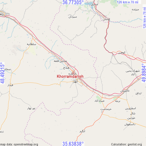
Khorramdarreh GPS coordinates[2]
36° 12' 27.972" North, 49° 11' 42.972" East
| Map corner | latitude | longitude |
|---|---|---|
| Upper-left | 36.77305°, | 48.49215° |
| Center: | 36.20777°, | 49.19527° |
| Lower-right: | 35.63838°, | 49.8984° |
| Map W x H: | 126.2×126.2 km | = 78.4×78.4mi |
| max Lat: | 39.6482° ⇑29.3% North |
| Khorramdarreh: | 36.20777° |
| min Lat: | ⇓70.7% South 25.2919° |
| min Long | Khorramdarreh | max Long |
| 44.38416° | 49.19527° | 61.9965° |
| W 30.6%⇐ | ⇒69.4% E |
Elevation
Elevation of Khorramdarreh is 1582 m = 5190 ft, and this is 533 m = 1749 ft above average elevation for this country.
| Max E: |
2564 m = 8412 ft | 25.2% |
| Khorramdarreh | 1582 m 5190 ft | |
| Avg. | 1049 m = 3442 ft | |
Min E: |
-24 m = -79 ft | 74.8% |
See also: Khorramdarreh elevation on elevation.city.
Geographical zone
Khorramdarreh is located in North temperate zone (between Tropic of Cancer and the Arctic Circle). Distance of this Northern Tropic circle is 1420 km =882.3 mi to South.| Distance of | km | miles | from Khorramdarreh |
|---|---|---|---|
| North Pole | 5981.1 | 3716.5 | to North |
| Arctic Circle | 3375.2 | 2097.3 | to North |
| Tropic Cancer | 1420 | 882.3 | to South |
| Equator | 4025.9 | 2501.6 | to South |


Nearby cities:
15 places around Khorramdarreh: (largest is in red/bold)
• Abhar
7.1 km =4.4 mi,  163°
163°
• Alvand
12.6 km =7.8 mi,  348°
348°
• Alvand
78 km =48.5 mi,  91°
91°
• Bū’īn Zahrā
91.8 km =57 mi,  122°
122°
• Fūman
113.5 km =70.5 mi,  5°
5°
• Māsūleh
106.9 km =66.4 mi, 350°
• Pādegān-e Manjīl
62.5 km =38.8 mi,  18°
18°
• Pā’īn-e Bāzār-e Rūdbār
71.3 km =44.3 mi, 16°
• Qazvin
72.9 km =45.3 mi,  84°
84°
• Razan
92.5 km =57.5 mi,  189°
189°
• Shaft
108.6 km =67.5 mi, 9°
• Tākestān
47.5 km =29.5 mi,  108°
108°
• Zanjān
81.4 km =50.6 mi,  309°
309°
• Zarrīnābād
85.4 km =53.1 mi,  286°
286°
• Ābbar
82.6 km =51.3 mi, 345°
Sources, notices
• [Note1] Compared only with cities in Iran existing in our database
• [Src1] Map data: © OpenStreetMap contributors (CC-BY-SA)
• [Src2] Other city data from geonames.org with taken over terms of usage.
• [Src3] Geographical zone / Annual Mean Temperature by Robert A. Rohde @ Wikipedia
