Numata geodata
Numata (Gunma) is a seat of a second-order administrative division; located in Japan in Asia/Tokyo (GMT+9) time zone. With population of 45,526 people, there are 404 cities with bigger population in this country. Compared to other cities in Japan, 78.9% of cities are located further ↓South; 61.2% of cities are located further ←West and 95.5% of cities have lower elevation than Numata. Note1


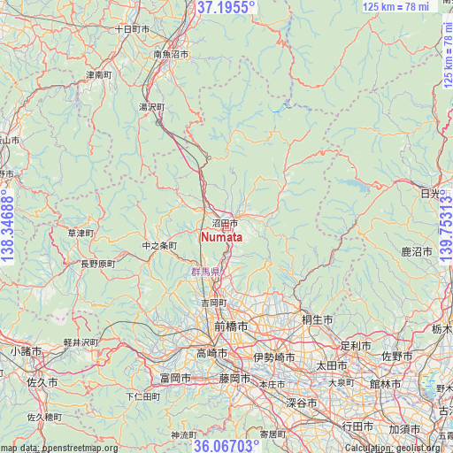
Numata GPS coordinates[2]
36° 37' 59.988" North, 139° 3' 0" East
| Map corner | latitude | longitude |
|---|---|---|
| Upper-left | 37.1955°, | 138.34688° |
| Center: | 36.63333°, | 139.05° |
| Lower-right: | 36.06703°, | 139.75313° |
| Map W x H: | 125.5×125.5 km | = 78×78mi |
| max Lat: | 45.40944° ⇑21.1% North |
| Numata: | 36.63333° |
| min Lat: | ⇓78.9% South 24.34478° |
| min Long | Numata | max Long |
| 123° | 139.05° | 145.575° |
| W 61.2%⇐ | ⇒38.8% E |
Elevation
Elevation of Numata is 376 m = 1234 ft, and this is 291.4 m = 956 ft above average elevation for this country.
| Max E: |
1086 m = 3563 ft | 4.5% |
| Numata | 376 m 1234 ft | |
| Avg. | 84.6 m = 278 ft | |
Min E: |
-2 m = -7 ft | 95.5% |
See also: Numata elevation on elevation.city.
Geographical zone
Numata is located in North temperate zone (between Tropic of Cancer and the Arctic Circle). Distance of this Northern Tropic circle is 1467.3 km =911.7 mi to South.| Distance of | km | miles | from Numata |
|---|---|---|---|
| North Pole | 5933.8 | 3687.1 | to North |
| Arctic Circle | 3327.9 | 2067.9 | to North |
| Tropic Cancer | 1467.3 | 911.7 | to South |
| Equator | 4073.2 | 2531 | to South |


Nearby cities:
15 places around Numata: (largest is in red/bold)
• Annaka
36.4 km =22.6 mi,  202°
202°
• Fujioka
43.1 km =26.8 mi,  177°
177°
• Isesaki
37.7 km =23.4 mi,  159°
159°
• Kanekomachi
25.2 km =15.7 mi,  191°
191°
• Kiryū
36.3 km =22.6 mi,  135°
135°
• Maebashi
26.1 km =16.2 mi,  173°
173°
• Midori
29.6 km =18.4 mi, 135°
• Nakanojōmachi
19.4 km =12.1 mi,  254°
254°
• Sakai-nakajima
44.5 km =27.7 mi, 156°
• Shibukawa
17.3 km =10.7 mi, 194°
• Takasaki
33.5 km =20.8 mi, 185°
• Tamamura
37.5 km =23.3 mi, 170°
• Tomioka
44.3 km =27.5 mi, 197°
• Yoshii
43 km =26.7 mi, 187°
• Ōmamachō-ōmama
30.1 km =18.7 mi, 138°
Sources, notices
• [Note1] Compared only with cities in Japan existing in our database
• [Src1] Map data: © OpenStreetMap contributors (CC-BY-SA)
• [Src2] Other city data from geonames.org with taken over terms of usage.
• [Src3] Geographical zone / Annual Mean Temperature by Robert A. Rohde @ Wikipedia
