Obanazawa geodata
Obanazawa (Yamagata) is a seat of a second-order administrative division; located in Japan in Asia/Tokyo (GMT+9) time zone. With population of 20,821 people, there are 678 cities with bigger population in this country. Compared to other cities in Japan, 89.9% of cities are located further ↓South; 85.1% of cities are located further ←West and 74.4% of cities have lower elevation than Obanazawa. Note1


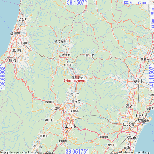
Obanazawa GPS coordinates[2]
38° 36' 11.988" North, 140° 24' 6.984" East
| Map corner | latitude | longitude |
|---|---|---|
| Upper-left | 39.1507°, | 139.69882° |
| Center: | 38.60333°, | 140.40194° |
| Lower-right: | 38.05175°, | 141.10507° |
| Map W x H: | 122.2×122.2 km | = 75.9×75.9mi |
| max Lat: | 45.40944° ⇑10.1% North |
| Obanazawa: | 38.60333° |
| min Lat: | ⇓89.9% South 24.34478° |
| min Long | Obanazawa | max Long |
| 123° | 140.40194° | 145.575° |
| W 85.1%⇐ | ⇒14.9% E |
Elevation
Elevation of Obanazawa is 93 m = 305 ft, and this is 8.4 m = 28 ft above average elevation for this country.
| Max E: |
1086 m = 3563 ft | 25.6% |
| Obanazawa | 93 m 305 ft | |
| Avg. | 84.6 m = 278 ft | |
Min E: |
-2 m = -7 ft | 74.4% |
See also: Japan elevation on elevation.city.
Geographical zone
Obanazawa is located in North temperate zone (between Tropic of Cancer and the Arctic Circle). Distance of this Northern Tropic circle is 1686.4 km =1047.9 mi to South.| Distance of | km | miles | from Obanazawa |
|---|---|---|---|
| North Pole | 5714.8 | 3551 | to North |
| Arctic Circle | 3108.9 | 1931.8 | to North |
| Tropic Cancer | 1686.4 | 1047.9 | to South |
| Equator | 4292.3 | 2667.1 | to South |


Nearby cities:
15 places around Obanazawa: (largest is in red/bold)
• Furukawa
48.2 km =30 mi,  94°
94°
• Higashine
18.3 km =11.4 mi,  180°
180°
• Kaminoyama
51.2 km =31.8 mi,  192°
192°
• Kogota
56.6 km =35.2 mi,  96°
96°
• Kurihara
54.4 km =33.8 mi,  72°
72°
• Murayama
14.9 km =9.3 mi, 175°
• Rifu
58.5 km =36.4 mi,  121°
121°
• Sagae
28 km =17.4 mi,  203°
203°
• Sendai
55.1 km =34.2 mi,  132°
132°
• Shinjō
19.4 km =12.1 mi,  333°
333°
• Tendō
27.9 km =17.3 mi, 185°
• Tomiya
48.2 km =30 mi, 119°
• Tsuruoka
52.1 km =32.4 mi,  284°
284°
• Yamagata
41.3 km =25.7 mi, 184°
• Ōsaki
49.7 km =30.9 mi, 91°
Sources, notices
• [Note1] Compared only with cities in Japan existing in our database
• [Src1] Map data: © OpenStreetMap contributors (CC-BY-SA)
• [Src2] Other city data from geonames.org with taken over terms of usage.
• [Src3] Geographical zone / Annual Mean Temperature by Robert A. Rohde @ Wikipedia
