Tsuruoka geodata
Tsuruoka (Yamagata) is a seat of a second-order administrative division; located in Japan in Asia/Tokyo (GMT+9) time zone. With population of 99,820 people, there are 204 cities with bigger population in this country. Compared to other cities in Japan, 90.1% of cities are located further ↓South; 75% of cities are located further ←West and 68.3% of cities have higher elevation than Tsuruoka. Note1


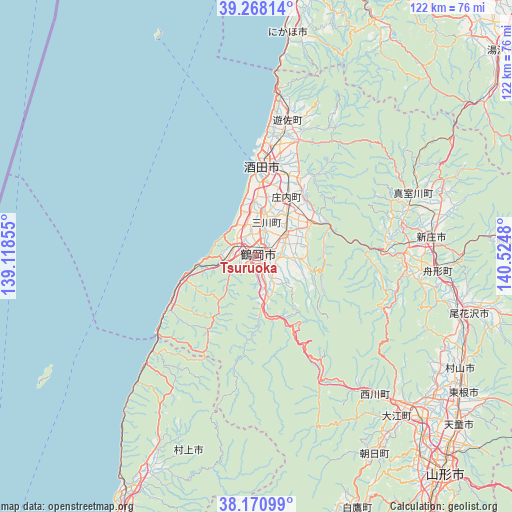
Tsuruoka GPS coordinates[2]
38° 43' 18.012" North, 139° 49' 18.012" East
| Map corner | latitude | longitude |
|---|---|---|
| Upper-left | 39.26814°, | 139.11855° |
| Center: | 38.72167°, | 139.82167° |
| Lower-right: | 38.17099°, | 140.5248° |
| Map W x H: | 122×122 km | = 75.8×75.8mi |
| max Lat: | 45.40944° ⇑9.9% North |
| Tsuruoka: | 38.72167° |
| min Lat: | ⇓90.1% South 24.34478° |
| min Long | Tsuruoka | max Long |
| 123° | 139.82167° | 145.575° |
| W 75%⇐ | ⇒25% E |
Elevation
Elevation of Tsuruoka is 13 m = 43 ft, and this is 71.6 m = 235 ft below average elevation for this country.
| Max E: |
1086 m = 3563 ft | 68.3% |
| Avg. | 84.6 m = 278 ft | |
| Tsuruoka | 13 m = 43 ft | |
Min E: |
-2 m = -7 ft | 31.7% |
See also: Tsuruoka elevation on elevation.city.
Geographical zone
Tsuruoka is located in North temperate zone (between Tropic of Cancer and the Arctic Circle). Distance of this Northern Tropic circle is 1699.5 km =1056 mi to South.| Distance of | km | miles | from Tsuruoka |
|---|---|---|---|
| North Pole | 5701.6 | 3542.8 | to North |
| Arctic Circle | 3095.7 | 1923.6 | to North |
| Tropic Cancer | 1699.5 | 1056 | to South |
| Equator | 4305.4 | 2675.3 | to South |


Nearby cities:
15 places around Tsuruoka: (largest is in red/bold)
• Higashine
59.3 km =36.8 mi,  122°
122°
• Kaminoyama
74.4 km =46.2 mi,  148°
148°
• Murakami
61.8 km =38.4 mi,  208°
208°
• Murayama
58.6 km =36.4 mi, 118°
• Nagai
71.2 km =44.2 mi,  164°
164°
• Nikaho
61.9 km =38.5 mi,  9°
9°
• Obanazawa
52.1 km =32.4 mi,  104°
104°
• Sagae
55.2 km =34.3 mi,  134°
134°
• Sakata
21.9 km =13.6 mi, 7°
• Shinjō
41.8 km =26 mi,  84°
84°
• Tendō
62.8 km =39 mi, 130°
• Yamagata
72.1 km =44.8 mi,  138°
138°
• Yurihonjō
77 km =47.8 mi,  15°
15°
• Yuza
34 km =21.1 mi, 15°
• Yuzawa
76.7 km =47.7 mi,  49°
49°
Sources, notices
• [Note1] Compared only with cities in Japan existing in our database
• [Src1] Map data: © OpenStreetMap contributors (CC-BY-SA)
• [Src2] Other city data from geonames.org with taken over terms of usage.
• [Src3] Geographical zone / Annual Mean Temperature by Robert A. Rohde @ Wikipedia
