Setouchi geodata
Setouchi (Okayama) is a seat of a second-order administrative division; located in Japan in Asia/Tokyo (GMT+9) time zone. In our database, there are 767 cities with bigger population. Compared to other cities in Japan, 69.5% of cities are located further ↑North; 74.6% of cities are located further →East and 79% of cities have higher elevation than Setouchi. Note1


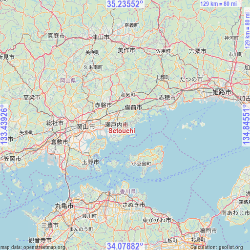
Setouchi GPS coordinates[2]
34° 39' 33.084" North, 134° 8' 32.568" East
| Map corner | latitude | longitude |
|---|---|---|
| Upper-left | 35.23552°, | 133.43926° |
| Center: | 34.65919°, | 134.14238° |
| Lower-right: | 34.07882°, | 134.84551° |
| Map W x H: | 128.6×128.6 km | = 79.9×79.9mi |
| max Lat: | 45.40944° ⇑69.5% North |
| Setouchi: | 34.65919° |
| min Lat: | ⇓30.5% South 24.34478° |
| min Long | Setouchi | max Long |
| 123° | 134.14238° | 145.575° |
| W 25.4%⇐ | ⇒74.6% E |
Elevation
Elevation of Setouchi is 8 m = 26 ft, and this is 76.6 m = 251 ft below average elevation for this country.
| Max E: |
1086 m = 3563 ft | 79% |
| Avg. | 84.6 m = 278 ft | |
| Setouchi | 8 m = 26 ft | |
Min E: |
-2 m = -7 ft | 21% |
See also: Japan elevation on elevation.city.
Geographical zone
Setouchi is located in North temperate zone (between Tropic of Cancer and the Arctic Circle). Distance of this Northern Tropic circle is 1247.8 km =775.3 mi to South.| Distance of | km | miles | from Setouchi |
|---|---|---|---|
| North Pole | 6153.3 | 3823.5 | to North |
| Arctic Circle | 3547.4 | 2204.3 | to North |
| Tropic Cancer | 1247.8 | 775.3 | to South |
| Equator | 3853.7 | 2394.6 | to South |


Nearby cities:
15 places around Setouchi: (largest is in red/bold)
• Aioi
33.8 km =21 mi,  61°
61°
• Akaiwa
20.1 km =12.5 mi,  326°
326°
• Ako
23.6 km =14.7 mi, 61°
• Bizen
16.5 km =10.3 mi,  30°
30°
• Kariya
24.6 km =15.3 mi,  65°
65°
• Kurashiki
35.4 km =22 mi,  256°
256°
• Mimasaka
43.2 km =26.8 mi,  9°
9°
• Okayama
19.1 km =11.9 mi,  266°
266°
• Shido
37.5 km =23.3 mi,  175°
175°
• Sōja
35.8 km =22.2 mi, 272°
• Takamatsu
37.2 km =23.1 mi,  193°
193°
• Tamano
23.9 km =14.9 mi,  228°
228°
• Tatsuno
41.4 km =25.7 mi, 62°
• Tatsunochō-tominaga
43.8 km =27.2 mi, 58°
• Tonoshō
20 km =12.4 mi,  172°
172°
Sources, notices
• [Note1] Compared only with cities in Japan existing in our database
• [Src1] Map data: © OpenStreetMap contributors (CC-BY-SA)
• [Src2] Other city data from geonames.org with taken over terms of usage.
• [Src3] Geographical zone / Annual Mean Temperature by Robert A. Rohde @ Wikipedia
