Ala-Buka geodata
Ala-Buka (Jalal-Abad) is a seat of a second-order administrative division; located in Kyrgyzstan in Asia/Bishkek (GMT+6) time zone. In our database, there are 37 cities with bigger population. Compared to other cities in Kyrgyzstan, 59.5% of cities are located further ↓South; 75% of cities are located further →East and 63.1% of cities have lower elevation than Ala-Buka. Note1


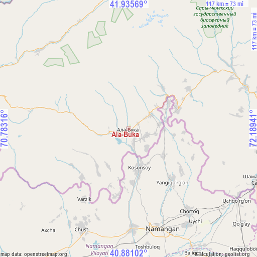
Ala-Buka GPS coordinates[2]
41° 24' 37.8" North, 71° 29' 10.608" East
| Map corner | latitude | longitude |
|---|---|---|
| Upper-left | 41.93569°, | 70.78316° |
| Center: | 41.4105°, | 71.48628° |
| Lower-right: | 40.88102°, | 72.18941° |
| Map W x H: | 117.3×117.3 km | = 72.9×72.9mi |
| max Lat: | 42.89106° ⇑40.5% North |
| Ala-Buka: | 41.4105° |
| min Lat: | ⇓59.5% South 39.55274° |
| min Long | Ala-Buka | max Long |
| 69.3716° | 71.48628° | 78.52702° |
| W 25%⇐ | ⇒75% E |
Elevation
Elevation of Ala-Buka is 1250 m = 4101 ft, and this is 48.6 m = 159 ft above average elevation for this country.
| Max E: |
2638 m = 8655 ft | 36.9% |
| Ala-Buka | 1250 m 4101 ft | |
| Avg. | 1201.4 m = 3942 ft | |
Min E: |
504 m = 1654 ft | 63.1% |
See also: Kyrgyzstan elevation on elevation.city.
Geographical zone
Ala-Buka is located in North temperate zone (between Tropic of Cancer and the Arctic Circle). Distance of this Northern Tropic circle is 1998.5 km =1241.8 mi to South.| Distance of | km | miles | from Ala-Buka |
|---|---|---|---|
| North Pole | 5402.6 | 3357 | to North |
| Arctic Circle | 2796.8 | 1737.9 | to North |
| Tropic Cancer | 1998.5 | 1241.8 | to South |
| Equator | 4604.4 | 2861 | to South |


Nearby cities:
15 places around Ala-Buka: (largest is in red/bold)
• Alga
130.6 km =81.2 mi,  179°
179°
• Aravan
130.9 km =81.3 mi,  139°
139°
• Bakai-Ata
125.7 km =78.1 mi,  16°
16°
• Bazar-Korgon
113.2 km =70.3 mi,  111°
111°
• Kanysh-Kyya
51.3 km =31.9 mi,  320°
320°
• Kerben
24.5 km =15.2 mi,  67°
67°
• Khalmion
133.8 km =83.1 mi,  174°
174°
• Kochkor-Ata
93.1 km =57.8 mi,  116°
116°
• Kyrgyz-Kyshtak
122.8 km =76.3 mi,  185°
185°
• Kyzyl-Adyr
134.7 km =83.7 mi,  3°
3°
• Markaz
134.7 km =83.7 mi, 165°
• Massy
103.5 km =64.3 mi, 112°
• Suzak
131.7 km =81.8 mi, 115°
• Tash-Kumyr
61.4 km =38.2 mi,  96°
96°
• Toktogul
131.5 km =81.7 mi, 66°
Sources, notices
• [Note1] Compared only with cities in Kyrgyzstan existing in our database
• [Src1] Map data: © OpenStreetMap contributors (CC-BY-SA)
• [Src2] Other city data from geonames.org with taken over terms of usage.
• [Src3] Geographical zone / Annual Mean Temperature by Robert A. Rohde @ Wikipedia
