Toktogul geodata
Toktogul (Jalal-Abad) is a seat of a second-order administrative division; located in Kyrgyzstan in Asia/Bishkek (GMT+6) time zone. With population of 19,336 people, there are 15 cities with bigger population in this country. Compared to other cities in Kyrgyzstan, 65.5% of cities are located further ↓South; 61.9% of cities are located further ←West and 59.5% of cities have higher elevation than Toktogul. Note1


Toktogul GPS coordinates[2]
41° 52' 27.912" North, 72° 56' 30.912" East
| Map corner | latitude | longitude |
|---|---|---|
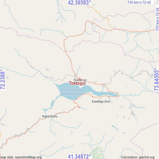
| Upper-left | 42.39583°, | 72.2388° |
| Center: | 41.87442°, | 72.94192° |
| Lower-right: | 41.34872°, | 73.64505° |
| Map W x H: | 116.4×116.4 km | = 72.3×72.3mi |
| max Lat: | 42.89106° ⇑34.5% North |
| Toktogul: | 41.87442° |
| min Lat: | ⇓65.5% South 39.55274° |
| min Long | Toktogul | max Long |
| 69.3716° | 72.94192° | 78.52702° |
| W 61.9%⇐ | ⇒38.1% E |
Elevation
Elevation of Toktogul is 987 m = 3238 ft, and this is 214.4 m = 703 ft below average elevation for this country.
| Max E: |
2638 m = 8655 ft | 59.5% |
| Avg. | 1201.4 m = 3942 ft | |
| Toktogul | 987 m = 3238 ft | |
Min E: |
504 m = 1654 ft | 40.5% |
See also: Kyrgyzstan elevation on elevation.city.
Geographical zone
Toktogul is located in North temperate zone (between Tropic of Cancer and the Arctic Circle). Distance of this Northern Tropic circle is 2050.1 km =1273.9 mi to South.| Distance of | km | miles | from Toktogul |
|---|---|---|---|
| North Pole | 5351.1 | 3325 | to North |
| Arctic Circle | 2745.2 | 1705.8 | to North |
| Tropic Cancer | 2050.1 | 1273.9 | to South |
| Equator | 4656 | 2893.1 | to South |


Nearby cities:
15 places around Toktogul: (largest is in red/bold)
• Bakai-Ata
108.5 km =67.4 mi,  309°
309°
• Bazar-Korgon
94.5 km =58.7 mi,  189°
189°
• Ivanovo-Alekseyevka
96.1 km =59.7 mi,  321°
321°
• Jalal-Abad
104.8 km =65.1 mi,  177°
177°
• Kaindy
121.7 km =75.6 mi,  29°
29°
• Kazarman
104.3 km =64.8 mi,  120°
120°
• Kerben
107 km =66.5 mi,  246°
246°
• Kochkor-Ata
100.6 km =62.5 mi,  202°
202°
• Massy
94.1 km =58.5 mi, 195°
• Sosnovka
115.6 km =71.8 mi,  42°
42°
• Suzak
108.6 km =67.5 mi, 181°
• Talas
58.4 km =36.3 mi,  336°
336°
• Talas
92.3 km =57.4 mi, 321°
• Tash-Kumyr
84.2 km =52.3 mi,  225°
225°
• Üch-Terek
24.8 km =15.4 mi, 120°
Sources, notices
• [Note1] Compared only with cities in Kyrgyzstan existing in our database
• [Src1] Map data: © OpenStreetMap contributors (CC-BY-SA)
• [Src2] Other city data from geonames.org with taken over terms of usage.
• [Src3] Geographical zone / Annual Mean Temperature by Robert A. Rohde @ Wikipedia
