Kyzyl-Adyr geodata
Kyzyl-Adyr (Talas) is a seat of a second-order administrative division; located in Kyrgyzstan in Asia/Bishkek (GMT+6) time zone. In our database, there are 37 cities with bigger population. Compared to other cities in Kyrgyzstan, 82.1% of cities are located further ↓South; 72.6% of cities are located further →East and 67.9% of cities have higher elevation than Kyzyl-Adyr. Note1


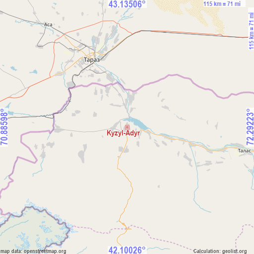
Kyzyl-Adyr GPS coordinates[2]
42° 37' 11.316" North, 71° 35' 20.76" East
| Map corner | latitude | longitude |
|---|---|---|
| Upper-left | 43.13506°, | 70.88598° |
| Center: | 42.61981°, | 71.5891° |
| Lower-right: | 42.10026°, | 72.29223° |
| Map W x H: | 115.1×115.1 km | = 71.5×71.5mi |
| max Lat: | 42.89106° ⇑17.9% North |
| Kyzyl-Adyr: | 42.61981° |
| min Lat: | ⇓82.1% South 39.55274° |
| min Long | Kyzyl-Adyr | max Long |
| 69.3716° | 71.5891° | 78.52702° |
| W 27.4%⇐ | ⇒72.6% E |
Elevation
Elevation of Kyzyl-Adyr is 919 m = 3015 ft, and this is 282.4 m = 927 ft below average elevation for this country.
| Max E: |
2638 m = 8655 ft | 67.9% |
| Avg. | 1201.4 m = 3942 ft | |
| Kyzyl-Adyr | 919 m = 3015 ft | |
Min E: |
504 m = 1654 ft | 32.1% |
See also: Kyrgyzstan elevation on elevation.city.
Geographical zone
Kyzyl-Adyr is located in North temperate zone (between Tropic of Cancer and the Arctic Circle). Distance of this Northern Tropic circle is 2133 km =1325.4 mi to South.| Distance of | km | miles | from Kyzyl-Adyr |
|---|---|---|---|
| North Pole | 5268.2 | 3273.5 | to North |
| Arctic Circle | 2662.3 | 1654.3 | to North |
| Tropic Cancer | 2133 | 1325.4 | to South |
| Equator | 4738.9 | 2944.6 | to South |


Nearby cities:
15 places around Kyzyl-Adyr: (largest is in red/bold)
• Ala-Buka
134.7 km =83.7 mi,  183°
183°
• Bakai-Ata
30.8 km =19.1 mi,  117°
117°
• Ivanovo-Alekseyevka
51.4 km =31.9 mi,  99°
99°
• Kaindy
172 km =106.9 mi,  82°
82°
• Kanysh-Kyya
103.5 km =64.3 mi,  203°
203°
• Kara-Balta
185.8 km =115.5 mi, 83°
• Kerben
126 km =78.3 mi,  173°
173°
• Kochkor-Ata
190.9 km =118.6 mi,  157°
157°
• Pokrovka
13.1 km =8.1 mi,  7°
7°
• Sosnovka
188.7 km =117.3 mi,  89°
89°
• Talas
54.6 km =33.9 mi, 101°
• Talas
92.4 km =57.4 mi,  108°
108°
• Tash-Kumyr
150.8 km =93.7 mi, 159°
• Toktogul
138.8 km =86.2 mi,  126°
126°
• Üch-Terek
163.4 km =101.5 mi, 125°
Sources, notices
• [Note1] Compared only with cities in Kyrgyzstan existing in our database
• [Src1] Map data: © OpenStreetMap contributors (CC-BY-SA)
• [Src2] Other city data from geonames.org with taken over terms of usage.
• [Src3] Geographical zone / Annual Mean Temperature by Robert A. Rohde @ Wikipedia
