Kerben geodata
Kerben (Jalal-Abad) is a seat of a second-order administrative division; located in Kyrgyzstan in Asia/Bishkek (GMT+6) time zone. With population of 14,141 people, there are 24 cities with bigger population in this country. Compared to other cities in Kyrgyzstan, 61.9% of cities are located further ↓South; 65.5% of cities are located further →East and 71.4% of cities have lower elevation than Kerben. Note1


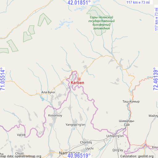
Kerben GPS coordinates[2]
41° 29' 38.364" North, 71° 45' 29.736" East
| Map corner | latitude | longitude |
|---|---|---|
| Upper-left | 42.01851°, | 71.05514° |
| Center: | 41.49399°, | 71.75826° |
| Lower-right: | 40.96519°, | 72.46139° |
| Map W x H: | 117.1×117.1 km | = 72.8×72.8mi |
| max Lat: | 42.89106° ⇑38.1% North |
| Kerben: | 41.49399° |
| min Lat: | ⇓61.9% South 39.55274° |
| min Long | Kerben | max Long |
| 69.3716° | 71.75826° | 78.52702° |
| W 34.5%⇐ | ⇒65.5% E |
Elevation
Elevation of Kerben is 1307 m = 4288 ft, and this is 105.6 m = 346 ft above average elevation for this country.
| Max E: |
2638 m = 8655 ft | 28.6% |
| Kerben | 1307 m 4288 ft | |
| Avg. | 1201.4 m = 3942 ft | |
Min E: |
504 m = 1654 ft | 71.4% |
See also: Kyrgyzstan elevation on elevation.city.
Geographical zone
Kerben is located in North temperate zone (between Tropic of Cancer and the Arctic Circle). Distance of this Northern Tropic circle is 2007.8 km =1247.6 mi to South.| Distance of | km | miles | from Kerben |
|---|---|---|---|
| North Pole | 5393.4 | 3351.3 | to North |
| Arctic Circle | 2787.5 | 1732.1 | to North |
| Tropic Cancer | 2007.8 | 1247.6 | to South |
| Equator | 4613.7 | 2866.8 | to South |


Nearby cities:
15 places around Kerben: (largest is in red/bold)
• Ala-Buka
24.5 km =15.2 mi,  247°
247°
• Aravan
125.3 km =77.9 mi,  150°
150°
• Bakai-Ata
111.9 km =69.5 mi,  7°
7°
• Bazar-Korgon
96.9 km =60.2 mi,  121°
121°
• Ivanovo-Alekseyevka
122.9 km =76.4 mi,  17°
17°
• Jalal-Abad
121.1 km =75.2 mi, 120°
• Kanysh-Kyya
63.1 km =39.2 mi,  298°
298°
• Kochkor-Ata
79.1 km =49.2 mi,  129°
129°
• Massy
87.6 km =54.4 mi, 123°
• Suzak
116.6 km =72.5 mi, 124°
• Talas
121.2 km =75.3 mi, 19°
• Talas
121.2 km =75.3 mi,  37°
37°
• Tash-Kumyr
41.6 km =25.8 mi,  113°
113°
• Toktogul
107 km =66.5 mi,  66°
66°
• Üch-Terek
123.5 km =76.7 mi,  76°
76°
Sources, notices
• [Note1] Compared only with cities in Kyrgyzstan existing in our database
• [Src1] Map data: © OpenStreetMap contributors (CC-BY-SA)
• [Src2] Other city data from geonames.org with taken over terms of usage.
• [Src3] Geographical zone / Annual Mean Temperature by Robert A. Rohde @ Wikipedia
