Tash-Kumyr geodata
Tash-Kumyr (Jalal-Abad) is a populated place; located in Kyrgyzstan in Asia/Bishkek (GMT+6) time zone. With population of 23,594 people, there are 13 cities with bigger population in this country. Compared to other cities in Kyrgyzstan, 57.1% of cities are located further ↓South; 52.4% of cities are located further →East and 98.8% of cities have higher elevation than Tash-Kumyr. Note1


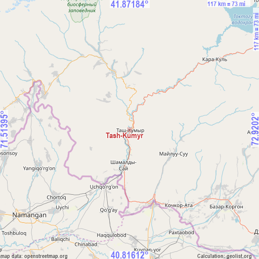
Tash-Kumyr GPS coordinates[2]
41° 20' 46.032" North, 72° 13' 1.452" East
| Map corner | latitude | longitude |
|---|---|---|
| Upper-left | 41.87184°, | 71.51395° |
| Center: | 41.34612°, | 72.21707° |
| Lower-right: | 40.81612°, | 72.9202° |
| Map W x H: | 117.4×117.4 km | = 72.9×72.9mi |
| max Lat: | 42.89106° ⇑42.9% North |
| Tash-Kumyr: | 41.34612° |
| min Lat: | ⇓57.1% South 39.55274° |
| min Long | Tash-Kumyr | max Long |
| 69.3716° | 72.21707° | 78.52702° |
| W 47.6%⇐ | ⇒52.4% E |
Elevation
Elevation of Tash-Kumyr is 612 m = 2008 ft, and this is 589.4 m = 1934 ft below average elevation for this country.
| Max E: |
2638 m = 8655 ft | 98.8% |
| Avg. | 1201.4 m = 3942 ft | |
| Tash-Kumyr | 612 m = 2008 ft | |
Min E: |
504 m = 1654 ft | 1.2% |
See also: Kyrgyzstan elevation on elevation.city.
Geographical zone
Tash-Kumyr is located in North temperate zone (between Tropic of Cancer and the Arctic Circle). Distance of this Northern Tropic circle is 1991.3 km =1237.3 mi to South.| Distance of | km | miles | from Tash-Kumyr |
|---|---|---|---|
| North Pole | 5409.8 | 3361.5 | to North |
| Arctic Circle | 2803.9 | 1742.3 | to North |
| Tropic Cancer | 1991.3 | 1237.3 | to South |
| Equator | 4597.3 | 2856.6 | to South |


Nearby cities:
15 places around Tash-Kumyr: (largest is in red/bold)
• Ala-Buka
61.4 km =38.2 mi,  276°
276°
• Aravan
95.3 km =59.2 mi,  165°
165°
• Bazar-Korgon
56 km =34.8 mi,  127°
127°
• Jalal-Abad
80 km =49.7 mi,  124°
124°
• Kanysh-Kyya
104.6 km =65 mi,  296°
296°
• Kara Suu
89.8 km =55.8 mi,  142°
142°
• Karavan
116.9 km =72.6 mi,  181°
181°
• Kerben
41.6 km =25.8 mi,  293°
293°
• Kochkor-Ata
40.9 km =25.4 mi,  147°
147°
• Massy
47.1 km =29.3 mi, 132°
• Osh
103.2 km =64.1 mi, 151°
• Suzak
76.1 km =47.3 mi, 130°
• Toktogul
84.2 km =52.3 mi,  45°
45°
• Uzgen
111.2 km =69.1 mi, 125°
• Üch-Terek
94 km =58.4 mi,  60°
60°
Sources, notices
• [Note1] Compared only with cities in Kyrgyzstan existing in our database
• [Src1] Map data: © OpenStreetMap contributors (CC-BY-SA)
• [Src2] Other city data from geonames.org with taken over terms of usage.
• [Src3] Geographical zone / Annual Mean Temperature by Robert A. Rohde @ Wikipedia
