Kanysh-Kyya geodata
Kanysh-Kyya (Jalal-Abad) is a seat of a second-order administrative division; located in Kyrgyzstan in Asia/Bishkek (GMT+6) time zone. In our database, there are 37 cities with bigger population. Compared to other cities in Kyrgyzstan, 64.3% of cities are located further ↓South; 81% of cities are located further →East and 84.5% of cities have lower elevation than Kanysh-Kyya. Note1


Kanysh-Kyya GPS coordinates[2]
41° 45' 55.296" North, 71° 5' 30.516" East
| Map corner | latitude | longitude |
|---|---|---|
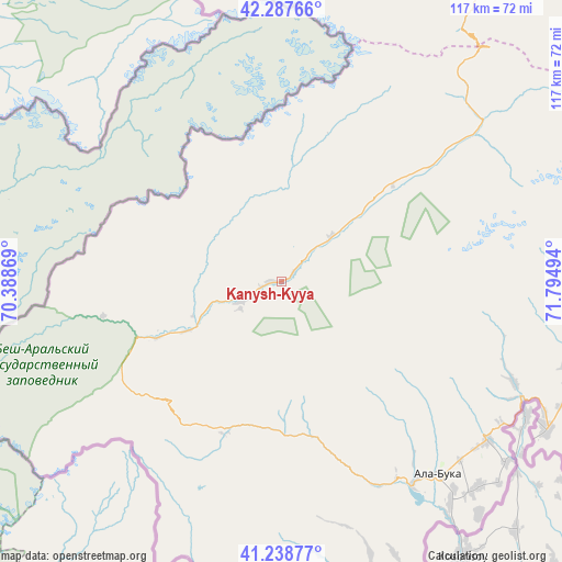
| Upper-left | 42.28766°, | 70.38869° |
| Center: | 41.76536°, | 71.09181° |
| Lower-right: | 41.23877°, | 71.79494° |
| Map W x H: | 116.6×116.6 km | = 72.5×72.5mi |
| max Lat: | 42.89106° ⇑35.7% North |
| Kanysh-Kyya: | 41.76536° |
| min Lat: | ⇓64.3% South 39.55274° |
| min Long | Kanysh-Kyya | max Long |
| 69.3716° | 71.09181° | 78.52702° |
| W 19%⇐ | ⇒81% E |
Elevation
Elevation of Kanysh-Kyya is 1711 m = 5614 ft, and this is 509.6 m = 1672 ft above average elevation for this country.
| Max E: |
2638 m = 8655 ft | 15.5% |
| Kanysh-Kyya | 1711 m 5614 ft | |
| Avg. | 1201.4 m = 3942 ft | |
Min E: |
504 m = 1654 ft | 84.5% |
See also: Kyrgyzstan elevation on elevation.city.
Geographical zone
Kanysh-Kyya is located in North temperate zone (between Tropic of Cancer and the Arctic Circle). Distance of this Northern Tropic circle is 2038 km =1266.4 mi to South.| Distance of | km | miles | from Kanysh-Kyya |
|---|---|---|---|
| North Pole | 5363.2 | 3332.5 | to North |
| Arctic Circle | 2757.3 | 1713.3 | to North |
| Tropic Cancer | 2038 | 1266.4 | to South |
| Equator | 4643.9 | 2885.6 | to South |


Nearby cities:
15 places around Kanysh-Kyya: (largest is in red/bold)
• Ala-Buka
51.3 km =31.9 mi,  140°
140°
• Alga
173.4 km =107.7 mi,  168°
168°
• Bakai-Ata
106.1 km =65.9 mi,  40°
40°
• Bazar-Korgon
159.9 km =99.4 mi,  120°
120°
• Ivanovo-Alekseyevka
126.6 km =78.7 mi,  46°
46°
• Kerben
63.1 km =39.2 mi, 118°
• Kochkor-Ata
141.5 km =87.9 mi, 124°
• Kyrgyz-Kyshtak
163.2 km =101.4 mi, 172°
• Kyzyl-Adyr
103.5 km =64.3 mi,  23°
23°
• Massy
150.5 km =93.5 mi, 121°
• Pokrovka
116.1 km =72.1 mi, 21°
• Talas
126.9 km =78.9 mi, 48°
• Talas
144.9 km =90 mi,  63°
63°
• Tash-Kumyr
104.6 km =65 mi, 116°
• Toktogul
153.8 km =95.6 mi,  85°
85°
Sources, notices
• [Note1] Compared only with cities in Kyrgyzstan existing in our database
• [Src1] Map data: © OpenStreetMap contributors (CC-BY-SA)
• [Src2] Other city data from geonames.org with taken over terms of usage.
• [Src3] Geographical zone / Annual Mean Temperature by Robert A. Rohde @ Wikipedia
