Maloye Ganyushkino geodata
Maloye Ganyushkino (Atyraū) is a section of populated place; located in Kazakhstan in Asia/Atyrau (GMT+5) time zone. With population of 8,387 people, there are 140 cities with bigger population in this country. Compared to other cities in Kazakhstan, 65.2% of cities are located further ↑North; 98.5% of cities are located further →East and 98.5% of cities have higher elevation than Maloye Ganyushkino. Note1


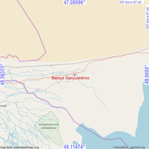
Maloye Ganyushkino GPS coordinates[2]
46° 36' 0" North, 49° 16' 0.012" East
| Map corner | latitude | longitude |
|---|---|---|
| Upper-left | 47.08096°, | 48.56355° |
| Center: | 46.6°, | 49.26667° |
| Lower-right: | 46.11474°, | 49.9698° |
| Map W x H: | 107.4×107.4 km | = 66.7×66.7mi |
| max Lat: | 54.90596° ⇑65.2% North |
| Maloye Ganyushkino: | 46.6° |
| min Lat: | ⇓34.8% South 40.66338° |
| min Long | Maloye Ganyushk | max Long |
| 46.83361° | 49.26667° | 84.87144° |
| W 1.5%⇐ | ⇒98.5% E |
Elevation
Elevation of Maloye Ganyushkino is -24 m = -79 ft, and this is 380.5 m = 1248 ft below average elevation for this country.
| Max E: |
1847 m = 6060 ft | 98.5% |
| Avg. | 356.5 m = 1170 ft | |
| Maloye Ganyushkino | -24 m = -79 ft | |
Min E: |
-26 m = -85 ft | 1.5% |
See also: Kazakhstan elevation on elevation.city.
Geographical zone
Maloye Ganyushkino is located in North temperate zone (between Tropic of Cancer and the Arctic Circle). Distance of this North polar circle is 2219.7 km =1379.3 mi to North.| Distance of | km | miles | from Maloye Ganyushkino |
|---|---|---|---|
| North Pole | 4825.6 | 2998.5 | to North |
| Arctic Circle | 2219.7 | 1379.3 | to North |
| Tropic Cancer | 2575.5 | 1600.3 | to South |
| Equator | 5181.4 | 3219.6 | to South |


Nearby cities:
15 places around Maloye Ganyushkino: (largest is in red/bold)
• Atyrau
207.1 km =128.7 mi,  73°
73°
• Balykshi
204.5 km =127.1 mi,  75°
75°
• Bayshonas
288 km =179 mi, 75°
• Baūtīno
240.9 km =149.7 mi,  161°
161°
• Dossor
299.6 km =186.2 mi, 69°
• Dzhangala
301.6 km =187.4 mi,  15°
15°
• Fort-Shevchenko
245.4 km =152.5 mi, 161°
• Inderbor
287.5 km =178.6 mi,  41°
41°
• Kaztalovka
354.6 km =220.3 mi,  353°
353°
• Makhambet
211.6 km =131.5 mi,  55°
55°
• Saykhin
309.9 km =192.6 mi,  324°
324°
• Shalkar
161.7 km =100.5 mi, 350°
• Shetpe
350.3 km =217.7 mi,  140°
140°
• Taūshyq
298.5 km =185.5 mi,  147°
147°
• Zhumysker
304.1 km =189 mi,  1°
1°
Sources, notices
• [Note1] Compared only with cities in Kazakhstan existing in our database
• [Src1] Map data: © OpenStreetMap contributors (CC-BY-SA)
• [Src2] Other city data from geonames.org with taken over terms of usage.
• [Src3] Geographical zone / Annual Mean Temperature by Robert A. Rohde @ Wikipedia
