Dzhangala geodata
Dzhangala is a populated place; located in Kazakhstan in Asia/Oral (GMT+5) time zone. With population of 5,954 people, there are 174 cities with bigger population in this country. Compared to other cities in Kazakhstan, 54.1% of cities are located further ↓South; 96.7% of cities are located further →East and 94.4% of cities have higher elevation than Dzhangala. Note1


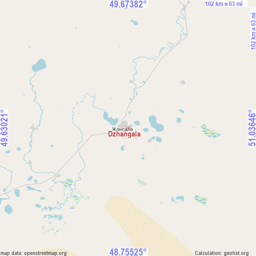
Dzhangala GPS coordinates[2]
49° 13' 0.012" North, 50° 19' 59.988" East
| Map corner | latitude | longitude |
|---|---|---|
| Upper-left | 49.67382°, | 49.63021° |
| Center: | 49.21667°, | 50.33333° |
| Lower-right: | 48.75525°, | 51.03646° |
| Map W x H: | 102.1×102.1 km | = 63.4×63.4mi |
| max Lat: | 54.90596° ⇑45.9% North |
| Dzhangala: | 49.21667° |
| min Lat: | ⇓54.1% South 40.66338° |
| min Long | Dzhangala | max Long |
| 46.83361° | 50.33333° | 84.87144° |
| W 3.3%⇐ | ⇒96.7% E |
Elevation
Elevation of Dzhangala is -2 m = -7 ft, and this is 358.5 m = 1176 ft below average elevation for this country.
| Max E: |
1847 m = 6060 ft | 94.4% |
| Avg. | 356.5 m = 1170 ft | |
| Dzhangala | -2 m = -7 ft | |
Min E: |
-26 m = -85 ft | 5.6% |
See also: Kazakhstan elevation on elevation.city.
Geographical zone
Dzhangala is located in North temperate zone (between Tropic of Cancer and the Arctic Circle). Distance of this North polar circle is 1928.8 km =1198.5 mi to North.| Distance of | km | miles | from Dzhangala |
|---|---|---|---|
| North Pole | 4534.7 | 2817.7 | to North |
| Arctic Circle | 1928.8 | 1198.5 | to North |
| Tropic Cancer | 2866.5 | 1781.2 | to South |
| Equator | 5472.4 | 3400.4 | to South |


Nearby cities:
15 places around Dzhangala: (largest is in red/bold)
• Akkol’
213.9 km =132.9 mi,  103°
103°
• Chapaev
124.7 km =77.5 mi,  28°
28°
• Dzhambeyty
199.7 km =124.1 mi,  54°
54°
• Fedorovka
251 km =156 mi, 27°
• Inderbor
129.4 km =80.4 mi,  124°
124°
• Kaztalovka
133.5 km =83 mi,  297°
297°
• Krūgloozernoe
217.9 km =135.4 mi,  18°
18°
• Makhambet
195.5 km =121.5 mi,  151°
151°
• Miyaly
254.7 km =158.3 mi, 98°
• Oral
236 km =146.6 mi, 18°
• Peremetnoe
223.5 km =138.9 mi,  9°
9°
• Shalkar
168.5 km =104.7 mi,  218°
218°
• Tasqala
210.6 km =130.9 mi,  359°
359°
• Zhumysker
68.9 km =42.8 mi,  280°
280°
• Zhänibek
253.7 km =157.6 mi, 275°
Sources, notices
• [Note1] Compared only with cities in Kazakhstan existing in our database
• [Src1] Map data: © OpenStreetMap contributors (CC-BY-SA)
• [Src2] Other city data from geonames.org with taken over terms of usage.
• [Src3] Geographical zone / Annual Mean Temperature by Robert A. Rohde @ Wikipedia
