Shalkar geodata
Shalkar (Atyraū) is a populated place; located in Kazakhstan in Asia/Atyrau (GMT+5) time zone. With population of 27,072 people, there are 55 cities with bigger population in this country. Compared to other cities in Kazakhstan, 55.2% of cities are located further ↑North; 98.9% of cities are located further →East and 95.9% of cities have higher elevation than Shalkar. Note1


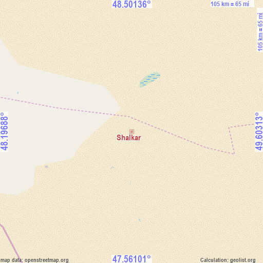
Shalkar GPS coordinates[2]
48° 1' 59.988" North, 48° 54' 0" East
| Map corner | latitude | longitude |
|---|---|---|
| Upper-left | 48.50136°, | 48.19688° |
| Center: | 48.03333°, | 48.9° |
| Lower-right: | 47.56101°, | 49.60313° |
| Map W x H: | 104.6×104.6 km | = 65×65mi |
| max Lat: | 54.90596° ⇑55.2% North |
| Shalkar: | 48.03333° |
| min Lat: | ⇓44.8% South 40.66338° |
| min Long | Shalkar | max Long |
| 46.83361° | 48.9° | 84.87144° |
| W 1.1%⇐ | ⇒98.9% E |
Elevation
Elevation of Shalkar is -14 m = -46 ft, and this is 370.5 m = 1216 ft below average elevation for this country.
| Max E: |
1847 m = 6060 ft | 95.9% |
| Avg. | 356.5 m = 1170 ft | |
| Shalkar | -14 m = -46 ft | |
Min E: |
-26 m = -85 ft | 4.1% |
See also: Kazakhstan elevation on elevation.city.
Geographical zone
Shalkar is located in North temperate zone (between Tropic of Cancer and the Arctic Circle). Distance of this North polar circle is 2060.4 km =1280.3 mi to North.| Distance of | km | miles | from Shalkar |
|---|---|---|---|
| North Pole | 4666.3 | 2899.5 | to North |
| Arctic Circle | 2060.4 | 1280.3 | to North |
| Tropic Cancer | 2734.9 | 1699.4 | to South |
| Equator | 5340.8 | 3318.6 | to South |


Nearby cities:
15 places around Shalkar: (largest is in red/bold)
• Atyrau
245.9 km =152.8 mi,  114°
114°
• Balykshi
247.2 km =153.6 mi,  115°
115°
• Baūtīno
401.4 km =249.4 mi,  165°
165°
• Chapaev
291.9 km =181.4 mi,  34°
34°
• Dzhangala
168.5 km =104.7 mi,  38°
38°
• Inderbor
220.9 km =137.3 mi,  74°
74°
• Kaztalovka
193.3 km =120.1 mi,  355°
355°
• Krūgloozernoe
379.9 km =236.1 mi, 26°
• Makhambet
204.3 km =126.9 mi,  101°
101°
• Maloye Ganyushkino
161.7 km =100.5 mi, 170°
• Peremetnoe
379.1 km =235.6 mi,  21°
21°
• Saykhin
177.7 km =110.4 mi,  300°
300°
• Tasqala
356.6 km =221.6 mi, 16°
• Zhumysker
149.1 km =92.6 mi,  14°
14°
• Zhänibek
215.7 km =134 mi,  315°
315°
Sources, notices
• [Note1] Compared only with cities in Kazakhstan existing in our database
• [Src1] Map data: © OpenStreetMap contributors (CC-BY-SA)
• [Src2] Other city data from geonames.org with taken over terms of usage.
• [Src3] Geographical zone / Annual Mean Temperature by Robert A. Rohde @ Wikipedia
