Zhumysker geodata
Zhumysker is a populated place; located in Kazakhstan in Asia/Oral (GMT+5) time zone. With population of 6,834 people, there are 158 cities with bigger population in this country. Compared to other cities in Kazakhstan, 54.8% of cities are located further ↓South; 98.1% of cities are located further →East and 94.1% of cities have higher elevation than Zhumysker. Note1


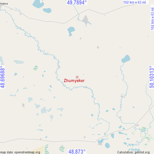
Zhumysker GPS coordinates[2]
49° 19' 59.988" North, 49° 24' 0" East
| Map corner | latitude | longitude |
|---|---|---|
| Upper-left | 49.7894°, | 48.69688° |
| Center: | 49.33333°, | 49.4° |
| Lower-right: | 48.873°, | 50.10313° |
| Map W x H: | 101.9×101.9 km | = 63.3×63.3mi |
| max Lat: | 54.90596° ⇑45.2% North |
| Zhumysker: | 49.33333° |
| min Lat: | ⇓54.8% South 40.66338° |
| min Long | Zhumysker | max Long |
| 46.83361° | 49.4° | 84.87144° |
| W 1.9%⇐ | ⇒98.1% E |
Elevation
Elevation of Zhumysker is -1 m = -3 ft, and this is 357.5 m = 1173 ft below average elevation for this country.
| Max E: |
1847 m = 6060 ft | 94.1% |
| Avg. | 356.5 m = 1170 ft | |
| Zhumysker | -1 m = -3 ft | |
Min E: |
-26 m = -85 ft | 5.9% |
See also: Kazakhstan elevation on elevation.city.
Geographical zone
Zhumysker is located in North temperate zone (between Tropic of Cancer and the Arctic Circle). Distance of this North polar circle is 1915.8 km =1190.4 mi to North.| Distance of | km | miles | from Zhumysker |
|---|---|---|---|
| North Pole | 4521.7 | 2809.7 | to North |
| Arctic Circle | 1915.8 | 1190.4 | to North |
| Tropic Cancer | 2879.4 | 1789.2 | to South |
| Equator | 5485.4 | 3408.5 | to South |


Nearby cities:
15 places around Zhumysker: (largest is in red/bold)
• Akkol’
282.8 km =175.7 mi,  102°
102°
• Chapaev
159.3 km =99 mi,  52°
52°
• Dzhambeyty
251.5 km =156.3 mi,  65°
65°
• Dzhangala
68.9 km =42.8 mi, 100°
• Fedorovka
277.6 km =172.5 mi,  40°
40°
• Inderbor
194.6 km =120.9 mi,  116°
116°
• Kaztalovka
70.3 km =43.7 mi,  313°
313°
• Krūgloozernoe
236.1 km =146.7 mi,  34°
34°
• Makhambet
245.4 km =152.5 mi,  139°
139°
• Oral
253.3 km =157.4 mi, 33°
• Peremetnoe
231.8 km =144 mi, 26°
• Saykhin
194.2 km =120.7 mi,  254°
254°
• Shalkar
149.1 km =92.6 mi,  194°
194°
• Tasqala
207.6 km =129 mi,  17°
17°
• Zhänibek
185.1 km =115 mi,  273°
273°
Sources, notices
• [Note1] Compared only with cities in Kazakhstan existing in our database
• [Src1] Map data: © OpenStreetMap contributors (CC-BY-SA)
• [Src2] Other city data from geonames.org with taken over terms of usage.
• [Src3] Geographical zone / Annual Mean Temperature by Robert A. Rohde @ Wikipedia
