Inderbor geodata
Inderbor (Atyraū) is a populated place; located in Kazakhstan in Asia/Atyrau (GMT+5) time zone. With population of 13,254 people, there are 91 cities with bigger population in this country. Compared to other cities in Kazakhstan, 53.7% of cities are located further ↑North; 93% of cities are located further →East and 91.5% of cities have higher elevation than Inderbor. Note1


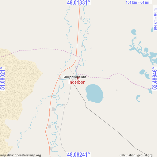
Inderbor GPS coordinates[2]
48° 33' 0" North, 51° 46' 59.988" East
| Map corner | latitude | longitude |
|---|---|---|
| Upper-left | 49.01331°, | 51.08021° |
| Center: | 48.55°, | 51.78333° |
| Lower-right: | 48.08241°, | 52.48646° |
| Map W x H: | 103.5×103.5 km | = 64.3×64.3mi |
| max Lat: | 54.90596° ⇑53.7% North |
| Inderbor: | 48.55° |
| min Lat: | ⇓46.3% South 40.66338° |
| min Long | Inderbor | max Long |
| 46.83361° | 51.78333° | 84.87144° |
| W 7%⇐ | ⇒93% E |
Elevation
Elevation of Inderbor is 22 m = 72 ft, and this is 334.5 m = 1097 ft below average elevation for this country.
| Max E: |
1847 m = 6060 ft | 91.5% |
| Avg. | 356.5 m = 1170 ft | |
| Inderbor | 22 m = 72 ft | |
Min E: |
-26 m = -85 ft | 8.5% |
See also: Kazakhstan elevation on elevation.city.
Geographical zone
Inderbor is located in North temperate zone (between Tropic of Cancer and the Arctic Circle). Distance of this North polar circle is 2002.9 km =1244.5 mi to North.| Distance of | km | miles | from Inderbor |
|---|---|---|---|
| North Pole | 4608.8 | 2863.8 | to North |
| Arctic Circle | 2002.9 | 1244.5 | to North |
| Tropic Cancer | 2792.3 | 1735.1 | to South |
| Equator | 5398.3 | 3354.3 | to South |


Nearby cities:
15 places around Inderbor: (largest is in red/bold)
• Akkol’
105.9 km =65.8 mi,  76°
76°
• Atyrau
159.5 km =99.1 mi,  177°
177°
• Balykshi
165 km =102.5 mi, 177°
• Bayshonas
169.2 km =105.1 mi,  149°
149°
• Chapaev
188.8 km =117.3 mi,  346°
346°
• Dossor
144.4 km =89.7 mi,  141°
141°
• Dzhambeyty
198.7 km =123.5 mi,  17°
17°
• Dzhangala
129.4 km =80.4 mi,  304°
304°
• Kaztalovka
262.5 km =163.1 mi, 301°
• Makhambet
99.3 km =61.7 mi,  188°
188°
• Maqat
151.6 km =94.2 mi,  131°
131°
• Miyaly
152 km =94.4 mi, 75°
• Qulsary
243.9 km =151.6 mi, 136°
• Shalkar
220.9 km =137.3 mi,  254°
254°
• Zhumysker
194.6 km =120.9 mi, 296°
Sources, notices
• [Note1] Compared only with cities in Kazakhstan existing in our database
• [Src1] Map data: © OpenStreetMap contributors (CC-BY-SA)
• [Src2] Other city data from geonames.org with taken over terms of usage.
• [Src3] Geographical zone / Annual Mean Temperature by Robert A. Rohde @ Wikipedia
