Atyrau geodata
Atyrau (Atyraū) is a seat of a first-order administrative division; located in Kazakhstan in Asia/Atyrau (GMT+5) time zone. With population of 180,000 people, there are 13 cities with bigger population in this country. Compared to other cities in Kazakhstan, 60.7% of cities are located further ↑North; 92.2% of cities are located further →East and 99.6% of cities have higher elevation than Atyrau. Note1


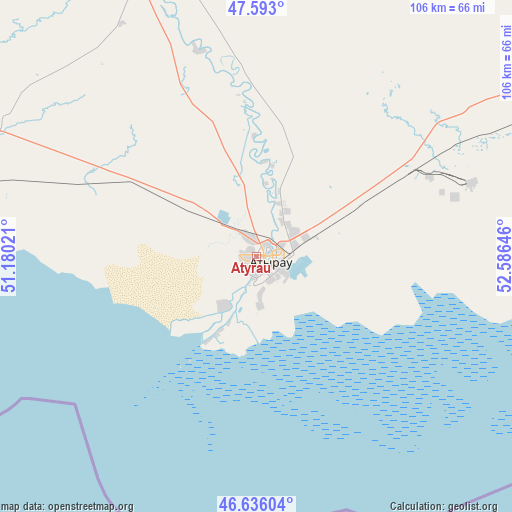
Atyrau GPS coordinates[2]
47° 7' 0.012" North, 51° 52' 59.988" East
| Map corner | latitude | longitude |
|---|---|---|
| Upper-left | 47.593°, | 51.18021° |
| Center: | 47.11667°, | 51.88333° |
| Lower-right: | 46.63604°, | 52.58646° |
| Map W x H: | 106.4×106.4 km | = 66.1×66.1mi |
| max Lat: | 54.90596° ⇑60.7% North |
| Atyrau: | 47.11667° |
| min Lat: | ⇓39.3% South 40.66338° |
| min Long | Atyrau | max Long |
| 46.83361° | 51.88333° | 84.87144° |
| W 7.8%⇐ | ⇒92.2% E |
Elevation
Elevation of Atyrau is -25 m = -82 ft, and this is 381.5 m = 1252 ft below average elevation for this country.
| Max E: |
1847 m = 6060 ft | 99.6% |
| Avg. | 356.5 m = 1170 ft | |
| Atyrau | -25 m = -82 ft | |
Min E: |
-26 m = -85 ft | 0.4% |
See also: Atyrau elevation on elevation.city.
Geographical zone
Atyrau is located in North temperate zone (between Tropic of Cancer and the Arctic Circle). Distance of this North polar circle is 2162.3 km =1343.6 mi to North.| Distance of | km | miles | from Atyrau |
|---|---|---|---|
| North Pole | 4768.2 | 2962.8 | to North |
| Arctic Circle | 2162.3 | 1343.6 | to North |
| Tropic Cancer | 2633 | 1636.1 | to South |
| Equator | 5238.9 | 3255.3 | to South |


Nearby cities:
15 places around Atyrau: (largest is in red/bold)
• Akkol’
208 km =129.2 mi,  27°
27°
• Balykshi
5.7 km =3.5 mi,  192°
192°
• Bayshonas
81.1 km =50.4 mi,  80°
80°
• Biikzhal
218 km =135.5 mi,  99°
99°
• Dossor
94.5 km =58.7 mi,  61°
61°
• Dzhangala
260.2 km =161.7 mi,  333°
333°
• Inderbor
159.5 km =99.1 mi,  357°
357°
• Makhambet
65.2 km =40.5 mi,  339°
339°
• Maloye Ganyushkino
207.1 km =128.7 mi,  253°
253°
• Maqat
123.1 km =76.5 mi, 61°
• Miyaly
242.5 km =150.7 mi,  35°
35°
• Qaraton
143.7 km =89.3 mi,  121°
121°
• Qulsary
162.9 km =101.2 mi, 96°
• Shalkar
245.9 km =152.8 mi,  294°
294°
• Zhumysker
307.5 km =191.1 mi,  323°
323°
Sources, notices
• [Note1] Compared only with cities in Kazakhstan existing in our database
• [Src1] Map data: © OpenStreetMap contributors (CC-BY-SA)
• [Src2] Other city data from geonames.org with taken over terms of usage.
• [Src3] Geographical zone / Annual Mean Temperature by Robert A. Rohde @ Wikipedia
