Dossor geodata
Dossor (Atyraū) is a populated place; located in Kazakhstan in Asia/Atyrau (GMT+5) time zone. With population of 9,526 people, there are 126 cities with bigger population in this country. Compared to other cities in Kazakhstan, 58.9% of cities are located further ↑North; 88.9% of cities are located further →East and 98.5% of cities have higher elevation than Dossor. Note1


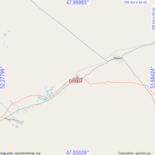
Dossor GPS coordinates[2]
47° 31' 37.992" North, 52° 58' 51.996" East
| Map corner | latitude | longitude |
|---|---|---|
| Upper-left | 47.99985°, | 52.27799° |
| Center: | 47.52722°, | 52.98111° |
| Lower-right: | 47.05029°, | 53.68424° |
| Map W x H: | 105.6×105.6 km | = 65.6×65.6mi |
| max Lat: | 54.90596° ⇑58.9% North |
| Dossor: | 47.52722° |
| min Lat: | ⇓41.1% South 40.66338° |
| min Long | Dossor | max Long |
| 46.83361° | 52.98111° | 84.87144° |
| W 11.1%⇐ | ⇒88.9% E |
Elevation
Elevation of Dossor is -24 m = -79 ft, and this is 380.5 m = 1248 ft below average elevation for this country.
| Max E: |
1847 m = 6060 ft | 98.5% |
| Avg. | 356.5 m = 1170 ft | |
| Dossor | -24 m = -79 ft | |
Min E: |
-26 m = -85 ft | 1.5% |
See also: Kazakhstan elevation on elevation.city.
Geographical zone
Dossor is located in North temperate zone (between Tropic of Cancer and the Arctic Circle). Distance of this North polar circle is 2116.6 km =1315.2 mi to North.| Distance of | km | miles | from Dossor |
|---|---|---|---|
| North Pole | 4722.5 | 2934.4 | to North |
| Arctic Circle | 2116.6 | 1315.2 | to North |
| Tropic Cancer | 2678.6 | 1664.4 | to South |
| Equator | 5284.5 | 3283.6 | to South |


Nearby cities:
15 places around Dossor: (largest is in red/bold)
• Akkol’
139.2 km =86.5 mi,  6°
6°
• Atyrau
94.5 km =58.7 mi,  241°
241°
• Balykshi
98.4 km =61.1 mi, 238°
• Bayganin
250.7 km =155.8 mi,  58°
58°
• Bayshonas
31.9 km =19.8 mi,  185°
185°
• Beyneu
298.9 km =185.7 mi,  145°
145°
• Biikzhal
154.5 km =96 mi,  121°
121°
• Dzhangala
271.1 km =168.5 mi,  313°
313°
• Inderbor
144.4 km =89.7 mi,  321°
321°
• Makhambet
105.9 km =65.8 mi,  278°
278°
• Maloye Ganyushkino
299.6 km =186.2 mi,  249°
249°
• Maqat
28.6 km =17.8 mi, 61°
• Miyaly
162.5 km =101 mi,  21°
21°
• Qaraton
127.3 km =79.1 mi,  162°
162°
• Qulsary
101.1 km =62.8 mi,  129°
129°
Sources, notices
• [Note1] Compared only with cities in Kazakhstan existing in our database
• [Src1] Map data: © OpenStreetMap contributors (CC-BY-SA)
• [Src2] Other city data from geonames.org with taken over terms of usage.
• [Src3] Geographical zone / Annual Mean Temperature by Robert A. Rohde @ Wikipedia
