Shetpe geodata
Shetpe (Mangghystaū) is a populated place; located in Kazakhstan in Asia/Aqtau (GMT+5) time zone. With population of 11,836 people, there are 98 cities with bigger population in this country. Compared to other cities in Kazakhstan, 79.3% of cities are located further ↑North; 90.7% of cities are located further →East and 64.1% of cities have higher elevation than Shetpe. Note1


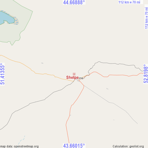
Shetpe GPS coordinates[2]
44° 10' 0.012" North, 52° 7' 0.012" East
| Map corner | latitude | longitude |
|---|---|---|
| Upper-left | 44.66888°, | 51.41355° |
| Center: | 44.16667°, | 52.11667° |
| Lower-right: | 43.66015°, | 52.8198° |
| Map W x H: | 112.2×112.2 km | = 69.7×69.7mi |
| max Lat: | 54.90596° ⇑79.3% North |
| Shetpe: | 44.16667° |
| min Lat: | ⇓20.7% South 40.66338° |
| min Long | Shetpe | max Long |
| 46.83361° | 52.11667° | 84.87144° |
| W 9.3%⇐ | ⇒90.7% E |
Elevation
Elevation of Shetpe is 209 m = 686 ft, and this is 147.5 m = 484 ft below average elevation for this country.
| Max E: |
1847 m = 6060 ft | 64.1% |
| Avg. | 356.5 m = 1170 ft | |
| Shetpe | 209 m = 686 ft | |
Min E: |
-26 m = -85 ft | 35.9% |
See also: Kazakhstan elevation on elevation.city.
Geographical zone
Shetpe is located in North temperate zone (between Tropic of Cancer and the Arctic Circle). Distance of this Northern Tropic circle is 2305 km =1432.3 mi to South.| Distance of | km | miles | from Shetpe |
|---|---|---|---|
| North Pole | 5096.2 | 3166.6 | to North |
| Arctic Circle | 2490.3 | 1547.4 | to North |
| Tropic Cancer | 2305 | 1432.3 | to South |
| Equator | 4910.9 | 3051.5 | to South |


Nearby cities:
15 places around Shetpe: (largest is in red/bold)
• Aktau
95.3 km =59.2 mi,  232°
232°
• Atyrau
328.5 km =204.1 mi,  356°
356°
• Balykshi
323 km =200.7 mi, 356°
• Baūtīno
154.5 km =96 mi,  285°
285°
• Beyneu
275 km =170.9 mi,  62°
62°
• Fort-Shevchenko
152.1 km =94.5 mi,  284°
284°
• Munayshy
75.1 km =46.7 mi,  180°
180°
• Qaraton
274 km =170.3 mi,  23°
23°
• Qulsary
343.4 km =213.4 mi,  25°
25°
• Sayötesh
114.2 km =71 mi,  80°
80°
• Taūshyq
64.3 km =40 mi, 288°
• Yeraliyev
115.1 km =71.5 mi,  197°
197°
• Zhanaozen
109.6 km =68.1 mi,  146°
146°
• Zhetibay
63.7 km =39.6 mi, 182°
• Ömirzaq
94.4 km =58.7 mi, 227°
Sources, notices
• [Note1] Compared only with cities in Kazakhstan existing in our database
• [Src1] Map data: © OpenStreetMap contributors (CC-BY-SA)
• [Src2] Other city data from geonames.org with taken over terms of usage.
• [Src3] Geographical zone / Annual Mean Temperature by Robert A. Rohde @ Wikipedia
