Baūtīno geodata
Baūtīno (Mangghystaū) is a populated place; located in Kazakhstan in Asia/Aqtau (GMT+5) time zone. With population of 3,247 people, there are 224 cities with bigger population in this country. Compared to other cities in Kazakhstan, 76.3% of cities are located further ↑North; 97.8% of cities are located further →East and 97.4% of cities have higher elevation than Baūtīno. Note1


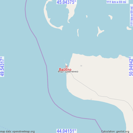
Baūtīno GPS coordinates[2]
44° 32' 41.244" North, 50° 14' 46.644" East
| Map corner | latitude | longitude |
|---|---|---|
| Upper-left | 45.04375°, | 49.54317° |
| Center: | 44.54479°, | 50.24629° |
| Lower-right: | 44.04151°, | 50.94942° |
| Map W x H: | 111.4×111.4 km | = 69.2×69.2mi |
| max Lat: | 54.90596° ⇑76.3% North |
| Baūtīno: | 44.54479° |
| min Lat: | ⇓23.7% South 40.66338° |
| min Long | Baūtīno | max Long |
| 46.83361° | 50.24629° | 84.87144° |
| W 2.2%⇐ | ⇒97.8% E |
Elevation
Elevation of Baūtīno is -22 m = -72 ft, and this is 378.5 m = 1242 ft below average elevation for this country.
| Max E: |
1847 m = 6060 ft | 97.4% |
| Avg. | 356.5 m = 1170 ft | |
| Baūtīno | -22 m = -72 ft | |
Min E: |
-26 m = -85 ft | 2.6% |
See also: Kazakhstan elevation on elevation.city.
Geographical zone
Baūtīno is located in North temperate zone (between Tropic of Cancer and the Arctic Circle). Distance of this Northern Tropic circle is 2347 km =1458.4 mi to South.| Distance of | km | miles | from Baūtīno |
|---|---|---|---|
| North Pole | 5054.1 | 3140.5 | to North |
| Arctic Circle | 2448.3 | 1521.3 | to North |
| Tropic Cancer | 2347 | 1458.4 | to South |
| Equator | 4952.9 | 3077.6 | to South |


Nearby cities:
15 places around Baūtīno: (largest is in red/bold)
• Aktau
123.7 km =76.9 mi,  143°
143°
• Atyrau
312.8 km =194.4 mi,  23°
23°
• Balykshi
307.2 km =190.9 mi, 24°
• Fort-Shevchenko
4.5 km =2.8 mi,  161°
161°
• Makhambet
362.1 km =225 mi, 16°
• Maloye Ganyushkino
240.9 km =149.7 mi,  341°
341°
• Munayshy
189.5 km =117.7 mi,  128°
128°
• Qaraton
328.5 km =204.1 mi,  50°
50°
• Sayötesh
262 km =162.8 mi,  95°
95°
• Shetpe
154.5 km =96 mi,  105°
105°
• Taūshyq
90.3 km =56.1 mi, 104°
• Yeraliyev
190.4 km =118.3 mi, 142°
• Zhanaozen
248.5 km =154.4 mi,  122°
122°
• Zhetibay
180.6 km =112.2 mi, 125°
• Ömirzaq
131.9 km =82 mi, 142°
Sources, notices
• [Note1] Compared only with cities in Kazakhstan existing in our database
• [Src1] Map data: © OpenStreetMap contributors (CC-BY-SA)
• [Src2] Other city data from geonames.org with taken over terms of usage.
• [Src3] Geographical zone / Annual Mean Temperature by Robert A. Rohde @ Wikipedia
