Kokpekty geodata
Kokpekty is a populated place; located in Kazakhstan in Asia/Almaty (GMT+5) time zone. With population of 5,165 people, there are 191 cities with bigger population in this country. Compared to other cities in Kazakhstan, 50.7% of cities are located further ↑North; 94.4% of cities are located further ←West and 77% of cities have lower elevation than Kokpekty. Note1


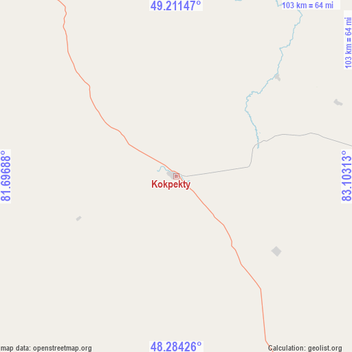
Kokpekty GPS coordinates[2]
48° 45' 0" North, 82° 24' 0" East
| Map corner | latitude | longitude |
|---|---|---|
| Upper-left | 49.21147°, | 81.69688° |
| Center: | 48.75°, | 82.4° |
| Lower-right: | 48.28426°, | 83.10313° |
| Map W x H: | 103.1×103.1 km | = 64.1×64.1mi |
| max Lat: | 54.90596° ⇑50.7% North |
| Kokpekty: | 48.75° |
| min Lat: | ⇓49.3% South 40.66338° |
| min Long | Kokpekty | max Long |
| 46.83361° | 82.4° | 84.87144° |
| W 94.4%⇐ | ⇒5.6% E |
Elevation
Elevation of Kokpekty is 514 m = 1686 ft, and this is 157.5 m = 517 ft above average elevation for this country.
| Max E: |
1847 m = 6060 ft | 23% |
| Kokpekty | 514 m 1686 ft | |
| Avg. | 356.5 m = 1170 ft | |
Min E: |
-26 m = -85 ft | 77% |
See also: Kazakhstan elevation on elevation.city.
Geographical zone
Kokpekty is located in North temperate zone (between Tropic of Cancer and the Arctic Circle). Distance of this North polar circle is 1980.7 km =1230.7 mi to North.| Distance of | km | miles | from Kokpekty |
|---|---|---|---|
| North Pole | 4586.6 | 2850 | to North |
| Arctic Circle | 1980.7 | 1230.7 | to North |
| Tropic Cancer | 2814.6 | 1748.9 | to South |
| Equator | 5420.5 | 3368.1 | to South |


Nearby cities:
15 places around Kokpekty: (largest is in red/bold)
• Aksuat
95.4 km =59.3 mi,  92°
92°
• Asūbulaq
101.9 km =63.3 mi,  28°
28°
• Auezov
122.2 km =75.9 mi,  330°
330°
• Belogorskīy
97.5 km =60.6 mi, 33°
• Belousovka
154 km =95.7 mi,  3°
3°
• Georgīevka
88 km =54.7 mi,  316°
316°
• Kurchum
94.9 km =59 mi,  102°
102°
• Ognevka
113 km =70.2 mi,  23°
23°
• Pervorosiyskiy
150.4 km =93.5 mi,  44°
44°
• Priisk Boko
65.1 km =40.5 mi,  302°
302°
• Shar
135.3 km =84.1 mi,  313°
313°
• Suykbulak
144.9 km =90 mi, 317°
• Ust-Kamenogorsk
136.6 km =84.9 mi,  6°
6°
• Zhalghyztobe
100.5 km =62.4 mi, 300°
• Zhanga Buqtyrma
127.4 km =79.2 mi, 39°
Sources, notices
• [Note1] Compared only with cities in Kazakhstan existing in our database
• [Src1] Map data: © OpenStreetMap contributors (CC-BY-SA)
• [Src2] Other city data from geonames.org with taken over terms of usage.
• [Src3] Geographical zone / Annual Mean Temperature by Robert A. Rohde @ Wikipedia
