Belousovka geodata
Belousovka (East Kazakhstan) is a populated place; located in Kazakhstan in Asia/Almaty (GMT+5) time zone. With population of 9,948 people, there are 114 cities with bigger population in this country. Compared to other cities in Kazakhstan, 65.9% of cities are located further ↓South; 95.2% of cities are located further ←West and 55.2% of cities have lower elevation than Belousovka. Note1


Belousovka GPS coordinates[2]
50° 7' 58.332" North, 82° 31' 29.316" East
| Map corner | latitude | longitude |
|---|---|---|
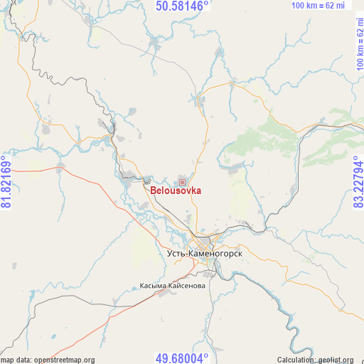
| Upper-left | 50.58146°, | 81.82169° |
| Center: | 50.13287°, | 82.52481° |
| Lower-right: | 49.68004°, | 83.22794° |
| Map W x H: | 100.2×100.2 km | = 62.3×62.3mi |
| max Lat: | 54.90596° ⇑34.1% North |
| Belousovka: | 50.13287° |
| min Lat: | ⇓65.9% South 40.66338° |
| min Long | Belousovka | max Long |
| 46.83361° | 82.52481° | 84.87144° |
| W 95.2%⇐ | ⇒4.8% E |
Elevation
Elevation of Belousovka is 365 m = 1198 ft, and this is 8.5 m = 28 ft above average elevation for this country.
| Max E: |
1847 m = 6060 ft | 44.8% |
| Belousovka | 365 m 1198 ft | |
| Avg. | 356.5 m = 1170 ft | |
Min E: |
-26 m = -85 ft | 55.2% |
See also: Kazakhstan elevation on elevation.city.
Geographical zone
Belousovka is located in North temperate zone (between Tropic of Cancer and the Arctic Circle). Distance of this North polar circle is 1826.9 km =1135.2 mi to North.| Distance of | km | miles | from Belousovka |
|---|---|---|---|
| North Pole | 4432.8 | 2754.4 | to North |
| Arctic Circle | 1826.9 | 1135.2 | to North |
| Tropic Cancer | 2968.3 | 1844.4 | to South |
| Equator | 5574.3 | 3463.7 | to South |


Nearby cities:
15 places around Belousovka: (largest is in red/bold)
• Altayskiy
17.1 km =10.6 mi,  317°
317°
• Asūbulaq
74.8 km =46.5 mi,  148°
148°
• Auezov
82.4 km =51.2 mi,  235°
235°
• Belogorskīy
85.5 km =53.1 mi, 148°
• Georgīevka
112.7 km =70 mi,  217°
217°
• Glubokoye
15.2 km =9.4 mi,  272°
272°
• Ognevka
61.1 km =38 mi,  144°
144°
• Pervorosiyskiy
105.5 km =65.6 mi,  116°
116°
• Ridder
74.1 km =46 mi,  71°
71°
• Shemonaīkha
70.1 km =43.6 mi, 321°
• Suykbulak
115.7 km =71.9 mi,  245°
245°
• Ust-Kamenogorsk
18.9 km =11.7 mi,  162°
162°
• Zhanga Buqtyrma
90.9 km =56.5 mi,  127°
127°
• Zhezkent
121 km =75.2 mi, 317°
• Ūst’-Talovka
66.6 km =41.4 mi,  314°
314°
Sources, notices
• [Note1] Compared only with cities in Kazakhstan existing in our database
• [Src1] Map data: © OpenStreetMap contributors (CC-BY-SA)
• [Src2] Other city data from geonames.org with taken over terms of usage.
• [Src3] Geographical zone / Annual Mean Temperature by Robert A. Rohde @ Wikipedia
