Auezov geodata
Auezov (East Kazakhstan) is a populated place; located in Kazakhstan in Asia/Almaty (GMT+5) time zone. With population of 4,209 people, there are 207 cities with bigger population in this country. Compared to other cities in Kazakhstan, 61.1% of cities are located further ↓South; 91.9% of cities are located further ←West and 61.9% of cities have lower elevation than Auezov. Note1


Auezov GPS coordinates[2]
49° 42' 36.108" North, 81° 34' 48.648" East
| Map corner | latitude | longitude |
|---|---|---|
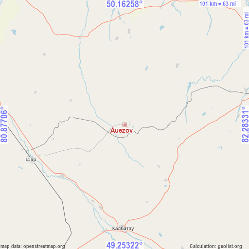
| Upper-left | 50.16258°, | 80.87706° |
| Center: | 49.71003°, | 81.58018° |
| Lower-right: | 49.25322°, | 82.28331° |
| Map W x H: | 101.1×101.1 km | = 62.8×62.8mi |
| max Lat: | 54.90596° ⇑38.9% North |
| Auezov: | 49.71003° |
| min Lat: | ⇓61.1% South 40.66338° |
| min Long | Auezov | max Long |
| 46.83361° | 81.58018° | 84.87144° |
| W 91.9%⇐ | ⇒8.1% E |
Elevation
Elevation of Auezov is 402 m = 1319 ft, and this is 45.5 m = 149 ft above average elevation for this country.
| Max E: |
1847 m = 6060 ft | 38.1% |
| Auezov | 402 m 1319 ft | |
| Avg. | 356.5 m = 1170 ft | |
Min E: |
-26 m = -85 ft | 61.9% |
See also: Kazakhstan elevation on elevation.city.
Geographical zone
Auezov is located in North temperate zone (between Tropic of Cancer and the Arctic Circle). Distance of this North polar circle is 1873.9 km =1164.4 mi to North.| Distance of | km | miles | from Auezov |
|---|---|---|---|
| North Pole | 4479.8 | 2783.6 | to North |
| Arctic Circle | 1873.9 | 1164.4 | to North |
| Tropic Cancer | 2921.3 | 1815.2 | to South |
| Equator | 5527.2 | 3434.4 | to South |


Nearby cities:
15 places around Auezov: (largest is in red/bold)
• Altayskiy
81.7 km =50.8 mi,  43°
43°
• Asūbulaq
108.2 km =67.2 mi,  99°
99°
• Belogorskīy
115.9 km =72 mi, 102°
• Belousovka
82.4 km =51.2 mi,  55°
55°
• Borodulikha
121.3 km =75.4 mi,  337°
337°
• Georgīevka
42.6 km =26.5 mi,  180°
180°
• Glubokoye
70.8 km =44 mi,  47°
47°
• Ognevka
103.4 km =64.2 mi,  91°
91°
• Priisk Boko
72.4 km =45 mi, 176°
• Shar
40.6 km =25.2 mi,  250°
250°
• Shemonaīkha
104.8 km =65.1 mi,  13°
13°
• Suykbulak
38.2 km =23.7 mi,  269°
269°
• Ust-Kamenogorsk
79.1 km =49.2 mi,  68°
68°
• Zhalghyztobe
61.4 km =38.2 mi,  205°
205°
• Ūst’-Talovka
95.3 km =59.2 mi, 11°
Sources, notices
• [Note1] Compared only with cities in Kazakhstan existing in our database
• [Src1] Map data: © OpenStreetMap contributors (CC-BY-SA)
• [Src2] Other city data from geonames.org with taken over terms of usage.
• [Src3] Geographical zone / Annual Mean Temperature by Robert A. Rohde @ Wikipedia
