Ognevka geodata
Ognevka (East Kazakhstan) is a populated place; located in Kazakhstan in Asia/Almaty (GMT+5) time zone. With population of 1,722 people, there are 250 cities with bigger population in this country. Compared to other cities in Kazakhstan, 59.3% of cities are located further ↓South; 95.9% of cities are located further ←West and 56.3% of cities have lower elevation than Ognevka. Note1


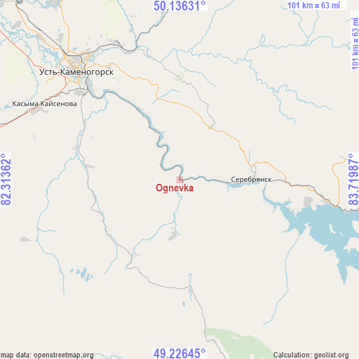
Ognevka GPS coordinates[2]
49° 41' 0.636" North, 83° 1' 0.264" East
| Map corner | latitude | longitude |
|---|---|---|
| Upper-left | 50.13631°, | 82.31362° |
| Center: | 49.68351°, | 83.01674° |
| Lower-right: | 49.22645°, | 83.71987° |
| Map W x H: | 101.2×101.2 km | = 62.9×62.9mi |
| max Lat: | 54.90596° ⇑40.7% North |
| Ognevka: | 49.68351° |
| min Lat: | ⇓59.3% South 40.66338° |
| min Long | Ognevka | max Long |
| 46.83361° | 83.01674° | 84.87144° |
| W 95.9%⇐ | ⇒4.1% E |
Elevation
Elevation of Ognevka is 369 m = 1211 ft, and this is 12.5 m = 41 ft above average elevation for this country.
| Max E: |
1847 m = 6060 ft | 43.7% |
| Ognevka | 369 m 1211 ft | |
| Avg. | 356.5 m = 1170 ft | |
Min E: |
-26 m = -85 ft | 56.3% |
See also: Kazakhstan elevation on elevation.city.
Geographical zone
Ognevka is located in North temperate zone (between Tropic of Cancer and the Arctic Circle). Distance of this North polar circle is 1876.9 km =1166.3 mi to North.| Distance of | km | miles | from Ognevka |
|---|---|---|---|
| North Pole | 4482.8 | 2785.5 | to North |
| Arctic Circle | 1876.9 | 1166.3 | to North |
| Tropic Cancer | 2918.4 | 1813.4 | to South |
| Equator | 5524.3 | 3432.6 | to South |


Nearby cities:
15 places around Ognevka: (largest is in red/bold)
• Aksuat
118.4 km =73.6 mi,  155°
155°
• Altayskiy
78.1 km =48.5 mi,  323°
323°
• Asūbulaq
14.5 km =9 mi,  166°
166°
• Auezov
103.4 km =64.2 mi,  271°
271°
• Belogorskīy
24.8 km =15.4 mi, 157°
• Belousovka
61.1 km =38 mi, 324°
• Georgīevka
111.5 km =69.3 mi,  249°
249°
• Glubokoye
71.5 km =44.4 mi, 315°
• Kokpekty
113 km =70.2 mi,  203°
203°
• Maleyevsk
92.7 km =57.6 mi,  80°
80°
• Pervorosiyskiy
60 km =37.3 mi,  86°
86°
• Ridder
81.6 km =50.7 mi,  25°
25°
• Ust-Kamenogorsk
43.5 km =27 mi, 317°
• Zhanga Buqtyrma
37.1 km =23.1 mi,  99°
99°
• Zyryanovsk
90.5 km =56.2 mi, 86°
Sources, notices
• [Note1] Compared only with cities in Kazakhstan existing in our database
• [Src1] Map data: © OpenStreetMap contributors (CC-BY-SA)
• [Src2] Other city data from geonames.org with taken over terms of usage.
• [Src3] Geographical zone / Annual Mean Temperature by Robert A. Rohde @ Wikipedia
