Zhalghyztobe geodata
Zhalghyztobe (East Kazakhstan) is a populated place; located in Kazakhstan in Asia/Almaty (GMT+5) time zone. With population of 4,400 people, there are 204 cities with bigger population in this country. Compared to other cities in Kazakhstan, 53.7% of cities are located further ↓South; 90.7% of cities are located further ←West and 68.1% of cities have lower elevation than Zhalghyztobe. Note1


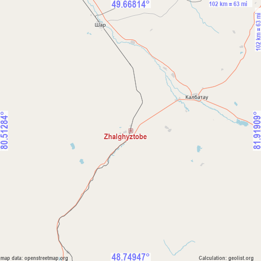
Zhalghyztobe GPS coordinates[2]
49° 12' 39.384" North, 81° 12' 57.456" East
| Map corner | latitude | longitude |
|---|---|---|
| Upper-left | 49.66814°, | 80.51284° |
| Center: | 49.21094°, | 81.21596° |
| Lower-right: | 48.74947°, | 81.91909° |
| Map W x H: | 102.1×102.1 km | = 63.4×63.4mi |
| max Lat: | 54.90596° ⇑46.3% North |
| Zhalghyztobe: | 49.21094° |
| min Lat: | ⇓53.7% South 40.66338° |
| min Long | Zhalghyztobe | max Long |
| 46.83361° | 81.21596° | 84.87144° |
| W 90.7%⇐ | ⇒9.3% E |
Elevation
Elevation of Zhalghyztobe is 453 m = 1486 ft, and this is 96.5 m = 317 ft above average elevation for this country.
| Max E: |
1847 m = 6060 ft | 31.9% |
| Zhalghyztobe | 453 m 1486 ft | |
| Avg. | 356.5 m = 1170 ft | |
Min E: |
-26 m = -85 ft | 68.1% |
See also: Kazakhstan elevation on elevation.city.
Geographical zone
Zhalghyztobe is located in North temperate zone (between Tropic of Cancer and the Arctic Circle). Distance of this North polar circle is 1929.4 km =1198.9 mi to North.| Distance of | km | miles | from Zhalghyztobe |
|---|---|---|---|
| North Pole | 4535.3 | 2818.1 | to North |
| Arctic Circle | 1929.4 | 1198.9 | to North |
| Tropic Cancer | 2865.8 | 1780.7 | to South |
| Equator | 5471.7 | 3400 | to South |


Nearby cities:
15 places around Zhalghyztobe: (largest is in red/bold)
• Altayskiy
141.5 km =87.9 mi,  35°
35°
• Asūbulaq
139.2 km =86.5 mi,  73°
73°
• Auezov
61.4 km =38.2 mi,  25°
25°
• Ayagoz
150 km =93.2 mi,  202°
202°
• Belogorskīy
143.1 km =88.9 mi,  78°
78°
• Belousovka
139.2 km =86.5 mi, 42°
• Georgīevka
29 km =18 mi,  63°
63°
• Glubokoye
129.8 km =80.7 mi, 37°
• Kokpekty
100.5 km =62.4 mi,  120°
120°
• Ognevka
140.4 km =87.2 mi, 68°
• Priisk Boko
35.4 km =22 mi, 118°
• Qaraūyl
145.8 km =90.6 mi,  258°
258°
• Shar
43.5 km =27 mi,  343°
343°
• Suykbulak
56.6 km =35.2 mi,  347°
347°
• Ust-Kamenogorsk
131.1 km =81.5 mi,  49°
49°
Sources, notices
• [Note1] Compared only with cities in Kazakhstan existing in our database
• [Src1] Map data: © OpenStreetMap contributors (CC-BY-SA)
• [Src2] Other city data from geonames.org with taken over terms of usage.
• [Src3] Geographical zone / Annual Mean Temperature by Robert A. Rohde @ Wikipedia
