Shar geodata
Shar (East Kazakhstan) is a populated place; located in Kazakhstan in Asia/Almaty (GMT+5) time zone. With population of 9,087 people, there are 130 cities with bigger population in this country. Compared to other cities in Kazakhstan, 57% of cities are located further ↓South; 90.4% of cities are located further ←West and 50.7% of cities have lower elevation than Shar. Note1


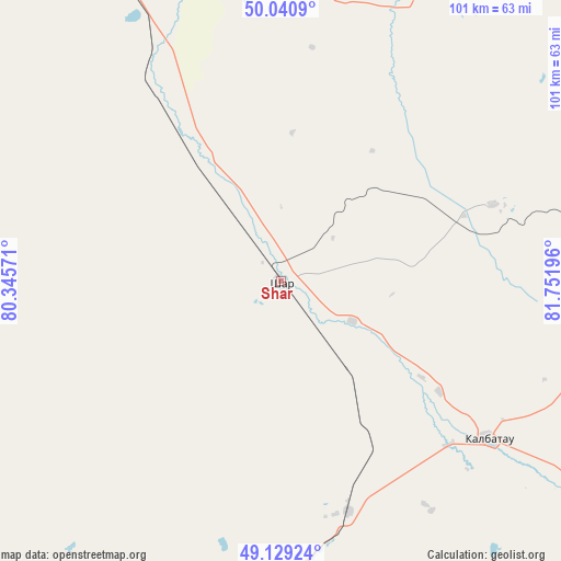
Shar GPS coordinates[2]
49° 35' 13.92" North, 81° 2' 55.788" East
| Map corner | latitude | longitude |
|---|---|---|
| Upper-left | 50.0409°, | 80.34571° |
| Center: | 49.5872°, | 81.04883° |
| Lower-right: | 49.12924°, | 81.75196° |
| Map W x H: | 101.4×101.4 km | = 63×63mi |
| max Lat: | 54.90596° ⇑43% North |
| Shar: | 49.5872° |
| min Lat: | ⇓57% South 40.66338° |
| min Long | Shar | max Long |
| 46.83361° | 81.04883° | 84.87144° |
| W 90.4%⇐ | ⇒9.6% E |
Elevation
Elevation of Shar is 339 m = 1112 ft, and this is 17.5 m = 57 ft below average elevation for this country.
| Max E: |
1847 m = 6060 ft | 49.3% |
| Avg. | 356.5 m = 1170 ft | |
| Shar | 339 m = 1112 ft | |
Min E: |
-26 m = -85 ft | 50.7% |
See also: Kazakhstan elevation on elevation.city.
Geographical zone
Shar is located in North temperate zone (between Tropic of Cancer and the Arctic Circle). Distance of this North polar circle is 1887.6 km =1172.9 mi to North.| Distance of | km | miles | from Shar |
|---|---|---|---|
| North Pole | 4493.5 | 2792.1 | to North |
| Arctic Circle | 1887.6 | 1172.9 | to North |
| Tropic Cancer | 2907.7 | 1806.8 | to South |
| Equator | 5513.6 | 3426 | to South |


Nearby cities:
15 places around Shar: (largest is in red/bold)
• Altayskiy
119.2 km =74.1 mi,  52°
52°
• Auezov
40.6 km =25.2 mi,  70°
70°
• Belousovka
122 km =75.8 mi,  60°
60°
• Borodulikha
126.1 km =78.4 mi,  356°
356°
• Georgīevka
47.7 km =29.6 mi,  127°
127°
• Glubokoye
109.3 km =67.9 mi, 55°
• Kokpekty
135.3 km =84.1 mi, 133°
• Ognevka
142.1 km =88.3 mi,  85°
85°
• Priisk Boko
72.8 km =45.2 mi,  143°
143°
• Semey
108.8 km =67.6 mi,  329°
329°
• Shemonaīkha
131.1 km =81.5 mi,  28°
28°
• Suykbulak
13.5 km =8.4 mi, 359°
• Ust-Kamenogorsk
119.7 km =74.4 mi, 69°
• Zhalghyztobe
43.5 km =27 mi,  163°
163°
• Ūst’-Talovka
121.3 km =75.4 mi, 28°
Sources, notices
• [Note1] Compared only with cities in Kazakhstan existing in our database
• [Src1] Map data: © OpenStreetMap contributors (CC-BY-SA)
• [Src2] Other city data from geonames.org with taken over terms of usage.
• [Src3] Geographical zone / Annual Mean Temperature by Robert A. Rohde @ Wikipedia
