Glubokoye geodata
Glubokoye (East Kazakhstan) is a populated place; located in Kazakhstan in Asia/Almaty (GMT+5) time zone. With population of 11,192 people, there are 104 cities with bigger population in this country. Compared to other cities in Kazakhstan, 66.3% of cities are located further ↓South; 93.7% of cities are located further ←West and 55.6% of cities have higher elevation than Glubokoye. Note1


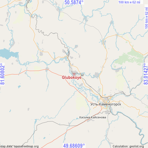
Glubokoye GPS coordinates[2]
50° 8' 19.932" North, 82° 18' 40.104" East
| Map corner | latitude | longitude |
|---|---|---|
| Upper-left | 50.5874°, | 81.60802° |
| Center: | 50.13887°, | 82.31114° |
| Lower-right: | 49.68609°, | 83.01427° |
| Map W x H: | 100.2×100.2 km | = 62.3×62.3mi |
| max Lat: | 54.90596° ⇑33.7% North |
| Glubokoye: | 50.13887° |
| min Lat: | ⇓66.3% South 40.66338° |
| min Long | Glubokoye | max Long |
| 46.83361° | 82.31114° | 84.87144° |
| W 93.7%⇐ | ⇒6.3% E |
Elevation
Elevation of Glubokoye is 277 m = 909 ft, and this is 79.5 m = 261 ft below average elevation for this country.
| Max E: |
1847 m = 6060 ft | 55.6% |
| Avg. | 356.5 m = 1170 ft | |
| Glubokoye | 277 m = 909 ft | |
Min E: |
-26 m = -85 ft | 44.4% |
See also: Kazakhstan elevation on elevation.city.
Geographical zone
Glubokoye is located in North temperate zone (between Tropic of Cancer and the Arctic Circle). Distance of this North polar circle is 1826.3 km =1134.8 mi to North.| Distance of | km | miles | from Glubokoye |
|---|---|---|---|
| North Pole | 4432.1 | 2754 | to North |
| Arctic Circle | 1826.3 | 1134.8 | to North |
| Tropic Cancer | 2969 | 1844.9 | to South |
| Equator | 5574.9 | 3464.1 | to South |


Nearby cities:
15 places around Glubokoye: (largest is in red/bold)
• Altayskiy
12.5 km =7.8 mi,  17°
17°
• Asūbulaq
84.2 km =52.3 mi,  140°
140°
• Auezov
70.8 km =44 mi,  227°
227°
• Belogorskīy
95 km =59 mi, 140°
• Belousovka
15.2 km =9.4 mi,  92°
92°
• Georgīevka
104.7 km =65.1 mi,  210°
210°
• Ognevka
71.5 km =44.4 mi, 135°
• Ridder
88.5 km =55 mi,  75°
75°
• Shar
109.3 km =67.9 mi,  235°
235°
• Shemonaīkha
61.3 km =38.1 mi,  332°
332°
• Suykbulak
102.3 km =63.6 mi, 242°
• Ust-Kamenogorsk
28.1 km =17.5 mi,  131°
131°
• Zhanga Buqtyrma
103.8 km =64.5 mi,  123°
123°
• Zhezkent
110.7 km =68.8 mi,  322°
322°
• Ūst’-Talovka
56.2 km =34.9 mi, 324°
Sources, notices
• [Note1] Compared only with cities in Kazakhstan existing in our database
• [Src1] Map data: © OpenStreetMap contributors (CC-BY-SA)
• [Src2] Other city data from geonames.org with taken over terms of usage.
• [Src3] Geographical zone / Annual Mean Temperature by Robert A. Rohde @ Wikipedia
