Ūst’-Talovka geodata
Ūst’-Talovka (East Kazakhstan) is a populated place; located in Kazakhstan in Asia/Almaty (GMT+5) time zone. With population of 6,122 people, there are 169 cities with bigger population in this country. Compared to other cities in Kazakhstan, 70.7% of cities are located further ↓South; 93% of cities are located further ←West and 52.2% of cities have higher elevation than Ūst’-Talovka. Note1


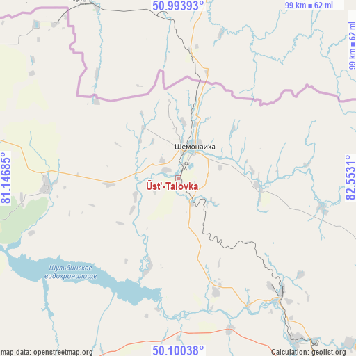
Ūst’-Talovka GPS coordinates[2]
50° 32' 57.372" North, 81° 50' 59.892" East
| Map corner | latitude | longitude |
|---|---|---|
| Upper-left | 50.99393°, | 81.14685° |
| Center: | 50.54927°, | 81.84997° |
| Lower-right: | 50.10038°, | 82.5531° |
| Map W x H: | 99.4×99.4 km | = 61.8×61.8mi |
| max Lat: | 54.90596° ⇑29.3% North |
| Ūst’-Talovka: | 50.54927° |
| min Lat: | ⇓70.7% South 40.66338° |
| min Long | Ūst’-Talovka | max Long |
| 46.83361° | 81.84997° | 84.87144° |
| W 93%⇐ | ⇒7% E |
Elevation
Elevation of Ūst’-Talovka is 302 m = 991 ft, and this is 54.5 m = 179 ft below average elevation for this country.
| Max E: |
1847 m = 6060 ft | 52.2% |
| Avg. | 356.5 m = 1170 ft | |
| Ūst’-Talovka | 302 m = 991 ft | |
Min E: |
-26 m = -85 ft | 47.8% |
See also: Kazakhstan elevation on elevation.city.
Geographical zone
Ūst’-Talovka is located in North temperate zone (between Tropic of Cancer and the Arctic Circle). Distance of this North polar circle is 1780.6 km =1106.4 mi to North.| Distance of | km | miles | from Ūst’-Talovka |
|---|---|---|---|
| North Pole | 4386.5 | 2725.6 | to North |
| Arctic Circle | 1780.6 | 1106.4 | to North |
| Tropic Cancer | 3014.6 | 1873.2 | to South |
| Equator | 5620.6 | 3492.5 | to South |


Nearby cities:
15 places around Ūst’-Talovka: (largest is in red/bold)
• Altayskiy
49.6 km =30.8 mi,  132°
132°
• Asūbulaq
140.3 km =87.2 mi,  141°
141°
• Auezov
95.3 km =59.2 mi,  191°
191°
• Belousovka
66.6 km =41.4 mi, 134°
• Borodulikha
67.6 km =42 mi,  286°
286°
• Georgīevka
137.4 km =85.4 mi, 188°
• Glubokoye
56.2 km =34.9 mi, 144°
• Ognevka
127.2 km =79 mi, 139°
• Ridder
119.9 km =74.5 mi,  100°
100°
• Semey
112.8 km =70.1 mi,  263°
263°
• Shar
121.3 km =75.4 mi,  208°
208°
• Shemonaīkha
9.8 km =6.1 mi,  26°
26°
• Suykbulak
109.6 km =68.1 mi, 211°
• Ust-Kamenogorsk
83.8 km =52.1 mi, 140°
• Zhezkent
54.6 km =33.9 mi,  321°
321°
Sources, notices
• [Note1] Compared only with cities in Kazakhstan existing in our database
• [Src1] Map data: © OpenStreetMap contributors (CC-BY-SA)
• [Src2] Other city data from geonames.org with taken over terms of usage.
• [Src3] Geographical zone / Annual Mean Temperature by Robert A. Rohde @ Wikipedia
