Dak Cheung geodata
Dak Cheung (Xékong) is a seat of a second-order administrative division; located in Laos in Asia/Vientiane (GMT+7) time zone. In our database, there are 24 cities with bigger population. Compared to other cities in Laos, 75% of cities are located further ↑North; 100% of cities are located further ←West and 90.4% of cities have lower elevation than Dak Cheung. Note1


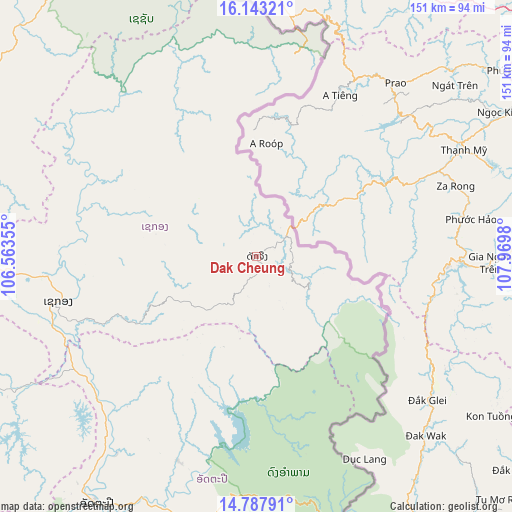
Dak Cheung GPS coordinates[2]
15° 28' 0.012" North, 107° 16' 0.012" East
| Map corner | latitude | longitude |
|---|---|---|
| Upper-left | 16.14321°, | 106.56355° |
| Center: | 15.46667°, | 107.26667° |
| Lower-right: | 14.78791°, | 107.9698° |
| Map W x H: | 150.7×150.7 km | = 93.6×93.6mi |
| max Lat: | 21.6808° ⇑75% North |
| Dak Cheung: | 15.46667° |
| min Lat: | ⇓25% South 14.11785° |
| min Long | Dak Cheung | max Long |
| 100.4178° | 107.26667° | 107.26667° |
| W 100%⇐ | ⇒0% E |
Elevation
Elevation of Dak Cheung is 1235 m = 4052 ft, and this is 761.4 m = 2498 ft above average elevation for this country.
| Max E: |
1722 m = 5650 ft | 9.6% |
| Dak Cheung | 1235 m 4052 ft | |
| Avg. | 473.6 m = 1554 ft | |
Min E: |
83 m = 272 ft | 90.4% |
See also: Laos elevation on elevation.city.
Geographical zone
Dak Cheung is located in North Torrid zone (between Equator and Tropic of Cancer). Distance of this Northern Tropic circle is 886.2 km =550.7 mi to North.| Distance of | km | miles | from Dak Cheung |
|---|---|---|---|
| North Pole | 8287.3 | 5149.5 | to North |
| Arctic Circle | 5681.4 | 3530.3 | to North |
| Tropic Cancer | 886.2 | 550.7 | to North |
| Equator | 1719.7 | 1068.6 | to South |


Nearby cities:
15 places around Dak Cheung: (largest is in red/bold)
• Attapeu
86.6 km =53.8 mi,  212°
212°
• Ban Fangdèng
80.9 km =50.3 mi, 206°
• Ban Hatgnao
114.2 km =71 mi,  220°
220°
• Ban Thatèng
94.8 km =58.9 mi,  267°
267°
• Champasak
162.2 km =100.8 mi,  246°
246°
• Lamam
61.6 km =38.3 mi,  264°
264°
• Muang Không
213.4 km =132.6 mi,  225°
225°
• Muang Phin
178.1 km =110.7 mi,  311°
311°
• Pakse
162.1 km =100.7 mi, 256°
• Pakxong
115.6 km =71.8 mi, 254°
• Phônthong
177.7 km =110.4 mi, 256°
• Salavan
95.1 km =59.1 mi,  286°
286°
• Sanaxy
49.4 km =30.7 mi,  180°
180°
• Sekong
59.7 km =37.1 mi, 257°
• Xaysetha
80.8 km =50.2 mi, 206°
Sources, notices
• [Note1] Compared only with cities in Laos existing in our database
• [Src1] Map data: © OpenStreetMap contributors (CC-BY-SA)
• [Src2] Other city data from geonames.org with taken over terms of usage.
• [Src3] Geographical zone / Annual Mean Temperature by Robert A. Rohde @ Wikipedia
