Salavan geodata
Salavan is a seat of a first-order administrative division; located in Laos in Asia/Vientiane (GMT+7) time zone. With population of 5,521 people, there are 17 cities with bigger population in this country. Compared to other cities in Laos, 73.1% of cities are located further ↑North; 84.6% of cities are located further ←West and 65.4% of cities have higher elevation than Salavan. Note1


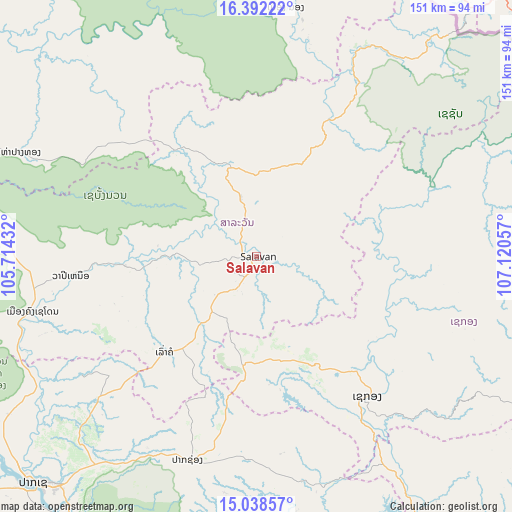
Salavan GPS coordinates[2]
15° 42' 59.472" North, 106° 25' 2.784" East
| Map corner | latitude | longitude |
|---|---|---|
| Upper-left | 16.39222°, | 105.71432° |
| Center: | 15.71652°, | 106.41744° |
| Lower-right: | 15.03857°, | 107.12057° |
| Map W x H: | 150.5×150.5 km | = 93.5×93.5mi |
| max Lat: | 21.6808° ⇑73.1% North |
| Salavan: | 15.71652° |
| min Lat: | ⇓26.9% South 14.11785° |
| min Long | Salavan | max Long |
| 100.4178° | 106.41744° | 107.26667° |
| W 84.6%⇐ | ⇒15.4% E |
Elevation
Elevation of Salavan is 183 m = 600 ft, and this is 290.6 m = 953 ft below average elevation for this country.
| Max E: |
1722 m = 5650 ft | 65.4% |
| Avg. | 473.6 m = 1554 ft | |
| Salavan | 183 m = 600 ft | |
Min E: |
83 m = 272 ft | 34.6% |
See also: Laos elevation on elevation.city.
Geographical zone
Salavan is located in North Torrid zone (between Equator and Tropic of Cancer). Distance of this Northern Tropic circle is 858.4 km =533.4 mi to North.| Distance of | km | miles | from Salavan |
|---|---|---|---|
| North Pole | 8259.5 | 5132.2 | to North |
| Arctic Circle | 5653.7 | 3513 | to North |
| Tropic Cancer | 858.4 | 533.4 | to North |
| Equator | 1747.5 | 1085.8 | to South |


Nearby cities:
15 places around Salavan: (largest is in red/bold)
• Attapeu
110.1 km =68.4 mi,  156°
156°
• Ban Dônghén
163.5 km =101.6 mi,  312°
312°
• Ban Fangdèng
114.7 km =71.3 mi,  151°
151°
• Ban Hatgnao
116.6 km =72.5 mi,  171°
171°
• Ban Thatèng
31.7 km =19.7 mi,  186°
186°
• Champasak
108.4 km =67.4 mi,  212°
212°
• Dak Cheung
95.1 km =59.1 mi,  106°
106°
• Lamam
44.6 km =27.7 mi,  138°
138°
• Muang Phin
100.1 km =62.2 mi,  335°
335°
• Pakse
93.8 km =58.3 mi,  224°
224°
• Pakxong
62.8 km =39 mi,  198°
198°
• Phônthong
106.7 km =66.3 mi,  230°
230°
• Sanaxy
118.9 km =73.9 mi,  130°
130°
• Sekong
52.7 km =32.7 mi, 141°
• Xaysetha
114.6 km =71.2 mi, 151°
Sources, notices
• [Note1] Compared only with cities in Laos existing in our database
• [Src1] Map data: © OpenStreetMap contributors (CC-BY-SA)
• [Src2] Other city data from geonames.org with taken over terms of usage.
• [Src3] Geographical zone / Annual Mean Temperature by Robert A. Rohde @ Wikipedia
