Ban Thatèng geodata
Ban Thatèng (Xékong) is a populated place; located in Laos in Asia/Vientiane (GMT+7) time zone. With population of 1,500 people, there are 23 cities with bigger population in this country. Compared to other cities in Laos, 76.9% of cities are located further ↑North; 82.7% of cities are located further ←West and 78.8% of cities have lower elevation than Ban Thatèng. Note1


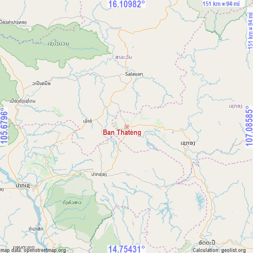
Ban Thatèng GPS coordinates[2]
15° 25' 59.412" North, 106° 22' 57.792" East
| Map corner | latitude | longitude |
|---|---|---|
| Upper-left | 16.10982°, | 105.6796° |
| Center: | 15.43317°, | 106.38272° |
| Lower-right: | 14.75431°, | 107.08585° |
| Map W x H: | 150.7×150.7 km | = 93.6×93.6mi |
| max Lat: | 21.6808° ⇑76.9% North |
| Ban Thatèng: | 15.43317° |
| min Lat: | ⇓23.1% South 14.11785° |
| min Long | Ban Thatèng | max Long |
| 100.4178° | 106.38272° | 107.26667° |
| W 82.7%⇐ | ⇒17.3% E |
Elevation
Elevation of Ban Thatèng is 856 m = 2808 ft, and this is 382.4 m = 1255 ft above average elevation for this country.
| Max E: |
1722 m = 5650 ft | 21.2% |
| Ban Thatèng | 856 m 2808 ft | |
| Avg. | 473.6 m = 1554 ft | |
Min E: |
83 m = 272 ft | 78.8% |
See also: Laos elevation on elevation.city.
Geographical zone
Ban Thatèng is located in North Torrid zone (between Equator and Tropic of Cancer). Distance of this Northern Tropic circle is 889.9 km =553 mi to North.| Distance of | km | miles | from Ban Thatèng |
|---|---|---|---|
| North Pole | 8291.1 | 5151.8 | to North |
| Arctic Circle | 5685.2 | 3532.6 | to North |
| Tropic Cancer | 889.9 | 553 | to North |
| Equator | 1716 | 1066.3 | to South |


Nearby cities:
15 places around Ban Thatèng: (largest is in red/bold)
• Attapeu
84.3 km =52.4 mi,  145°
145°
• Ban Fangdèng
90.9 km =56.5 mi,  139°
139°
• Ban Hatgnao
86.4 km =53.7 mi,  165°
165°
• Champasak
81 km =50.3 mi,  222°
222°
• Dak Cheung
94.8 km =58.9 mi,  87°
87°
• Lamam
33.5 km =20.8 mi, 93°
• Muang Không
156.9 km =97.5 mi,  201°
201°
• Muang Phin
128.3 km =79.7 mi,  342°
342°
• Pakse
71.6 km =44.5 mi,  240°
240°
• Pakxong
32.4 km =20.1 mi,  210°
210°
• Phônthong
86.4 km =53.7 mi, 244°
• Salavan
31.7 km =19.7 mi,  6°
6°
• Sanaxy
104.6 km =65 mi,  115°
115°
• Sekong
37.8 km =23.5 mi,  104°
104°
• Xaysetha
90.8 km =56.4 mi, 139°
Sources, notices
• [Note1] Compared only with cities in Laos existing in our database
• [Src1] Map data: © OpenStreetMap contributors (CC-BY-SA)
• [Src2] Other city data from geonames.org with taken over terms of usage.
• [Src3] Geographical zone / Annual Mean Temperature by Robert A. Rohde @ Wikipedia
