Pakxong geodata
Pakxong (Champasak) is a seat of a second-order administrative division; located in Laos in Asia/Vientiane (GMT+7) time zone. With population of 5,000 people, there are 18 cities with bigger population in this country. Compared to other cities in Laos, 82.7% of cities are located further ↑North; 80.8% of cities are located further ←West and 92.3% of cities have lower elevation than Pakxong. Note1


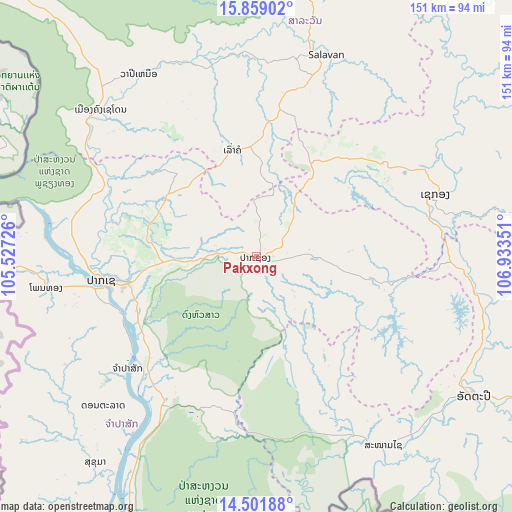
Pakxong GPS coordinates[2]
15° 10' 53.544" North, 106° 13' 49.368" East
| Map corner | latitude | longitude |
|---|---|---|
| Upper-left | 15.85902°, | 105.52726° |
| Center: | 15.18154°, | 106.23038° |
| Lower-right: | 14.50188°, | 106.93351° |
| Map W x H: | 150.9×150.9 km | = 93.8×93.8mi |
| max Lat: | 21.6808° ⇑82.7% North |
| Pakxong: | 15.18154° |
| min Lat: | ⇓17.3% South 14.11785° |
| min Long | Pakxong | max Long |
| 100.4178° | 106.23038° | 107.26667° |
| W 80.8%⇐ | ⇒19.2% E |
Elevation
Elevation of Pakxong is 1286 m = 4219 ft, and this is 812.4 m = 2665 ft above average elevation for this country.
| Max E: |
1722 m = 5650 ft | 7.7% |
| Pakxong | 1286 m 4219 ft | |
| Avg. | 473.6 m = 1554 ft | |
Min E: |
83 m = 272 ft | 92.3% |
See also: Laos elevation on elevation.city.
Geographical zone
Pakxong is located in North Torrid zone (between Equator and Tropic of Cancer). Distance of this Northern Tropic circle is 917.9 km =570.4 mi to North.| Distance of | km | miles | from Pakxong |
|---|---|---|---|
| North Pole | 8319 | 5169.2 | to North |
| Arctic Circle | 5713.1 | 3550 | to North |
| Tropic Cancer | 917.9 | 570.4 | to North |
| Equator | 1688 | 1048.9 | to South |


Nearby cities:
15 places around Pakxong: (largest is in red/bold)
• Attapeu
76.6 km =47.6 mi,  122°
122°
• Ban Fangdèng
86 km =53.4 mi, 118°
• Ban Hatgnao
67.3 km =41.8 mi,  145°
145°
• Ban Thatèng
32.4 km =20.1 mi,  30°
30°
• Champasak
49.7 km =30.9 mi,  229°
229°
• Dak Cheung
115.6 km =71.8 mi,  74°
74°
• Lamam
56.3 km =35 mi,  62°
62°
• Muang Không
125 km =77.7 mi,  198°
198°
• Muang Phin
152 km =94.4 mi,  351°
351°
• Pakse
46.8 km =29.1 mi,  261°
261°
• Phônthong
62.5 km =38.8 mi, 261°
• Salavan
62.8 km =39 mi,  18°
18°
• Sanaxy
112 km =69.6 mi,  99°
99°
• Sekong
56 km =34.8 mi, 70°
• Xaysetha
85.9 km =53.4 mi, 118°
Sources, notices
• [Note1] Compared only with cities in Laos existing in our database
• [Src1] Map data: © OpenStreetMap contributors (CC-BY-SA)
• [Src2] Other city data from geonames.org with taken over terms of usage.
• [Src3] Geographical zone / Annual Mean Temperature by Robert A. Rohde @ Wikipedia
