Muang Không geodata
Muang Không (Champasak) is a seat of a second-order administrative division; located in Laos in Asia/Vientiane (GMT+7) time zone. With population of 15,000 people, there are 11 cities with bigger population in this country. Compared to other cities in Laos, 100% of cities are located further ↑North; 75% of cities are located further ←West and 100% of cities have higher elevation than Muang Không. Note1


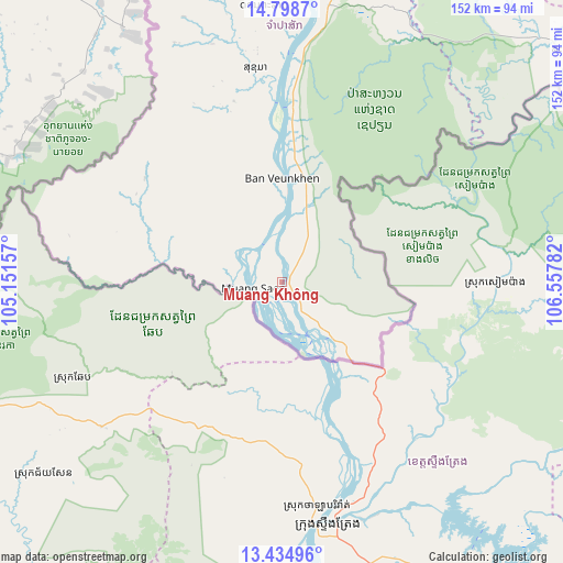
Muang Không GPS coordinates[2]
14° 7' 4.26" North, 105° 51' 16.884" East
| Map corner | latitude | longitude |
|---|---|---|
| Upper-left | 14.7987°, | 105.15157° |
| Center: | 14.11785°, | 105.85469° |
| Lower-right: | 13.43496°, | 106.55782° |
| Map W x H: | 151.6×151.6 km | = 94.2×94.2mi |
| max Lat: | 21.6808° ⇑100% North |
| Muang Không: | 14.11785° |
| min Lat: | ⇓0% South 14.11785° |
| min Long | Muang Không | max Long |
| 100.4178° | 105.85469° | 107.26667° |
| W 75%⇐ | ⇒25% E |
Elevation
Elevation of Muang Không is 83 m = 272 ft, and this is 390.6 m = 1281 ft below average elevation for this country.
| Max E: |
1722 m = 5650 ft | 100% |
| Avg. | 473.6 m = 1554 ft | |
| Muang Không | 83 m = 272 ft | |
Min E: |
83 m = 272 ft | 0% |
See also: Laos elevation on elevation.city.
Geographical zone
Muang Không is located in North Torrid zone (between Equator and Tropic of Cancer). Distance of this Northern Tropic circle is 1036.2 km =643.9 mi to North.| Distance of | km | miles | from Muang Không |
|---|---|---|---|
| North Pole | 8437.3 | 5242.7 | to North |
| Arctic Circle | 5831.4 | 3623.5 | to North |
| Tropic Cancer | 1036.2 | 643.9 | to North |
| Equator | 1569.8 | 975.4 | to South |


Nearby cities:
15 places around Muang Không: (largest is in red/bold)
• Attapeu
130.4 km =81 mi,  53°
53°
• Ban Fangdèng
139.6 km =86.7 mi,  56°
56°
• Ban Hatgnao
100.2 km =62.3 mi, 51°
• Ban Thatèng
156.9 km =97.5 mi,  21°
21°
• Champasak
86.1 km =53.5 mi,  1°
1°
• Dak Cheung
213.4 km =132.6 mi, 45°
• Lamam
170.4 km =105.9 mi,  32°
32°
• Muang Phin
269.3 km =167.3 mi, 3°
• Pakse
111.6 km =69.3 mi,  356°
356°
• Pakxong
125 km =77.7 mi, 18°
• Phônthong
111.4 km =69.2 mi,  348°
348°
• Salavan
187.8 km =116.7 mi, 18°
• Sanaxy
181.6 km =112.8 mi, 56°
• Sekong
165.5 km =102.8 mi, 34°
• Xaysetha
139.7 km =86.8 mi, 56°
Sources, notices
• [Note1] Compared only with cities in Laos existing in our database
• [Src1] Map data: © OpenStreetMap contributors (CC-BY-SA)
• [Src2] Other city data from geonames.org with taken over terms of usage.
• [Src3] Geographical zone / Annual Mean Temperature by Robert A. Rohde @ Wikipedia
