Ban Fangdèng geodata
Ban Fangdèng (Attapu) is a seat of a second-order administrative division; located in Laos in Asia/Vientiane (GMT+7) time zone. In our database, there are 24 cities with bigger population. Compared to other cities in Laos, 94.2% of cities are located further ↑North; 94.2% of cities are located further ←West and 88.5% of cities have higher elevation than Ban Fangdèng. Note1


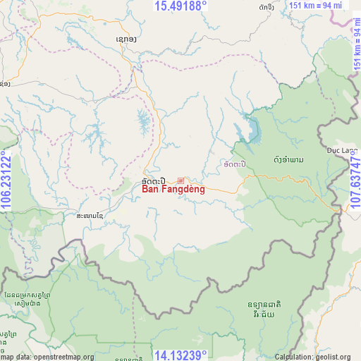
Ban Fangdèng GPS coordinates[2]
14° 48' 47.52" North, 106° 56' 3.624" East
| Map corner | latitude | longitude |
|---|---|---|
| Upper-left | 15.49188°, | 106.23122° |
| Center: | 14.8132°, | 106.93434° |
| Lower-right: | 14.13239°, | 107.63747° |
| Map W x H: | 151.2×151.2 km | = 94×94mi |
| max Lat: | 21.6808° ⇑94.2% North |
| Ban Fangdèng: | 14.8132° |
| min Lat: | ⇓5.8% South 14.11785° |
| min Long | Ban Fangdèng | max Long |
| 100.4178° | 106.93434° | 107.26667° |
| W 94.2%⇐ | ⇒5.8% E |
Elevation
Elevation of Ban Fangdèng is 106 m = 348 ft, and this is 367.6 m = 1206 ft below average elevation for this country.
| Max E: |
1722 m = 5650 ft | 88.5% |
| Avg. | 473.6 m = 1554 ft | |
| Ban Fangdèng | 106 m = 348 ft | |
Min E: |
83 m = 272 ft | 11.5% |
See also: Laos elevation on elevation.city.
Geographical zone
Ban Fangdèng is located in North Torrid zone (between Equator and Tropic of Cancer). Distance of this Northern Tropic circle is 958.8 km =595.8 mi to North.| Distance of | km | miles | from Ban Fangdèng |
|---|---|---|---|
| North Pole | 8360 | 5194.7 | to North |
| Arctic Circle | 5754.1 | 3575.4 | to North |
| Tropic Cancer | 958.8 | 595.8 | to North |
| Equator | 1647.1 | 1023.5 | to South |


Nearby cities:
15 places around Ban Fangdèng: (largest is in red/bold)
• Attapeu
11 km =6.8 mi,  268°
268°
• Ban Hatgnao
40.7 km =25.3 mi,  248°
248°
• Ban Thatèng
90.9 km =56.5 mi,  319°
319°
• Champasak
113.9 km =70.8 mi, 274°
• Dak Cheung
80.9 km =50.3 mi,  26°
26°
• Lamam
71.9 km =44.7 mi,  339°
339°
• Muang Không
139.6 km =86.7 mi,  236°
236°
• Muang Phin
214.7 km =133.4 mi,  333°
333°
• Pakse
126.6 km =78.7 mi,  285°
285°
• Pakxong
86 km =53.4 mi,  298°
298°
• Phônthong
141.2 km =87.7 mi,  283°
283°
• Salavan
114.7 km =71.3 mi, 331°
• Sanaxy
42 km =26.1 mi,  56°
56°
• Sekong
63.4 km =39.4 mi, 339°
• Xaysetha
0.1 km =0.1 mi,  4°
4°
Sources, notices
• [Note1] Compared only with cities in Laos existing in our database
• [Src1] Map data: © OpenStreetMap contributors (CC-BY-SA)
• [Src2] Other city data from geonames.org with taken over terms of usage.
• [Src3] Geographical zone / Annual Mean Temperature by Robert A. Rohde @ Wikipedia
