Ban Hatgnao geodata
Ban Hatgnao (Attapu) is a seat of a second-order administrative division; located in Laos in Asia/Vientiane (GMT+7) time zone. In our database, there are 24 cities with bigger population. Compared to other cities in Laos, 98.1% of cities are located further ↑North; 86.5% of cities are located further ←West and 98.1% of cities have higher elevation than Ban Hatgnao. Note1


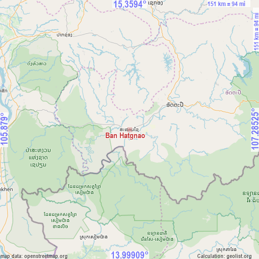
Ban Hatgnao GPS coordinates[2]
14° 40' 49.08" North, 106° 34' 55.632" East
| Map corner | latitude | longitude |
|---|---|---|
| Upper-left | 15.3594°, | 105.879° |
| Center: | 14.6803°, | 106.58212° |
| Lower-right: | 13.99909°, | 107.28525° |
| Map W x H: | 151.3×151.3 km | = 94×94mi |
| max Lat: | 21.6808° ⇑98.1% North |
| Ban Hatgnao: | 14.6803° |
| min Lat: | ⇓1.9% South 14.11785° |
| min Long | Ban Hatgnao | max Long |
| 100.4178° | 106.58212° | 107.26667° |
| W 86.5%⇐ | ⇒13.5% E |
Elevation
Elevation of Ban Hatgnao is 89 m = 292 ft, and this is 384.6 m = 1262 ft below average elevation for this country.
| Max E: |
1722 m = 5650 ft | 98.1% |
| Avg. | 473.6 m = 1554 ft | |
| Ban Hatgnao | 89 m = 292 ft | |
Min E: |
83 m = 272 ft | 1.9% |
See also: Laos elevation on elevation.city.
Geographical zone
Ban Hatgnao is located in North Torrid zone (between Equator and Tropic of Cancer). Distance of this Northern Tropic circle is 973.6 km =605 mi to North.| Distance of | km | miles | from Ban Hatgnao |
|---|---|---|---|
| North Pole | 8374.8 | 5203.9 | to North |
| Arctic Circle | 5768.9 | 3584.6 | to North |
| Tropic Cancer | 973.6 | 605 | to North |
| Equator | 1632.3 | 1014.3 | to South |


Nearby cities:
15 places around Ban Hatgnao: (largest is in red/bold)
• Attapeu
30.5 km =19 mi,  61°
61°
• Ban Fangdèng
40.7 km =25.3 mi,  68°
68°
• Ban Thatèng
86.4 km =53.7 mi,  345°
345°
• Champasak
79.3 km =49.3 mi,  287°
287°
• Dak Cheung
114.2 km =71 mi,  40°
40°
• Lamam
82.8 km =51.4 mi,  8°
8°
• Muang Không
100.2 km =62.3 mi,  231°
231°
• Muang Phin
214.6 km =133.3 mi,  343°
343°
• Pakse
97.3 km =60.5 mi,  300°
300°
• Pakxong
67.3 km =41.8 mi,  325°
325°
• Phônthong
110.1 km =68.4 mi, 295°
• Salavan
116.6 km =72.5 mi, 351°
• Sanaxy
82.2 km =51.1 mi, 62°
• Sekong
75.5 km =46.9 mi, 11°
• Xaysetha
40.7 km =25.3 mi, 68°
Sources, notices
• [Note1] Compared only with cities in Laos existing in our database
• [Src1] Map data: © OpenStreetMap contributors (CC-BY-SA)
• [Src2] Other city data from geonames.org with taken over terms of usage.
• [Src3] Geographical zone / Annual Mean Temperature by Robert A. Rohde @ Wikipedia
