Phônthong geodata
Phônthong (Champasak) is a seat of a second-order administrative division; located in Laos in Asia/Vientiane (GMT+7) time zone. In our database, there are 24 cities with bigger population. Compared to other cities in Laos, 86.5% of cities are located further ↑North; 71.2% of cities are located further ←West and 86.5% of cities have higher elevation than Phônthong. Note1


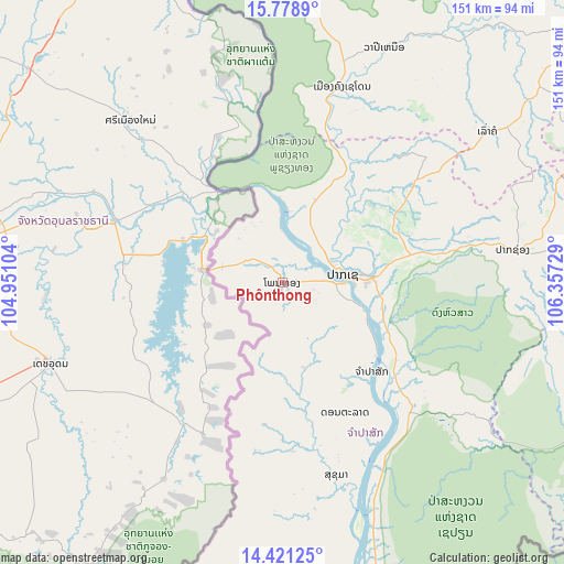
Phônthong GPS coordinates[2]
15° 6' 4.176" North, 105° 39' 14.976" East
| Map corner | latitude | longitude |
|---|---|---|
| Upper-left | 15.7789°, | 104.95104° |
| Center: | 15.10116°, | 105.65416° |
| Lower-right: | 14.42125°, | 106.35729° |
| Map W x H: | 151×151 km | = 93.8×93.8mi |
| max Lat: | 21.6808° ⇑86.5% North |
| Phônthong: | 15.10116° |
| min Lat: | ⇓13.5% South 14.11785° |
| min Long | Phônthong | max Long |
| 100.4178° | 105.65416° | 107.26667° |
| W 71.2%⇐ | ⇒28.8% E |
Elevation
Elevation of Phônthong is 109 m = 358 ft, and this is 364.6 m = 1196 ft below average elevation for this country.
| Max E: |
1722 m = 5650 ft | 86.5% |
| Avg. | 473.6 m = 1554 ft | |
| Phônthong | 109 m = 358 ft | |
Min E: |
83 m = 272 ft | 13.5% |
See also: Laos elevation on elevation.city.
Geographical zone
Phônthong is located in North Torrid zone (between Equator and Tropic of Cancer). Distance of this Northern Tropic circle is 926.8 km =575.9 mi to North.| Distance of | km | miles | from Phônthong |
|---|---|---|---|
| North Pole | 8328 | 5174.8 | to North |
| Arctic Circle | 5722.1 | 3555.5 | to North |
| Tropic Cancer | 926.8 | 575.9 | to North |
| Equator | 1679.1 | 1043.3 | to South |


Nearby cities:
15 places around Phônthong: (largest is in red/bold)
• Attapeu
130.6 km =81.2 mi,  104°
104°
• Ban Fangdèng
141.2 km =87.7 mi, 103°
• Ban Hatgnao
110.1 km =68.4 mi,  115°
115°
• Ban Thatèng
86.4 km =53.7 mi,  64°
64°
• Champasak
33.4 km =20.8 mi,  134°
134°
• Dak Cheung
177.7 km =110.4 mi,  76°
76°
• Lamam
117 km =72.7 mi,  72°
72°
• Muang Không
111.4 km =69.2 mi,  168°
168°
• Muang Phin
164.2 km =102 mi,  13°
13°
• Pakse
15.7 km =9.8 mi, 82°
• Pakxong
62.5 km =38.8 mi, 81°
• Salavan
106.7 km =66.3 mi,  50°
50°
• Sanaxy
172.7 km =107.3 mi,  92°
92°
• Sekong
117.9 km =73.3 mi, 76°
• Xaysetha
141.2 km =87.7 mi, 103°
Sources, notices
• [Note1] Compared only with cities in Laos existing in our database
• [Src1] Map data: © OpenStreetMap contributors (CC-BY-SA)
• [Src2] Other city data from geonames.org with taken over terms of usage.
• [Src3] Geographical zone / Annual Mean Temperature by Robert A. Rohde @ Wikipedia
