Muang Mok geodata
Muang Mok (Xiangkhoang) is a seat of a second-order administrative division; located in Laos in Asia/Vientiane (GMT+7) time zone. In our database, there are 24 cities with bigger population. Compared to other cities in Laos, 55.8% of cities are located further ↓South; 50% of cities are located further ←West and 84.6% of cities have lower elevation than Muang Mok. Note1


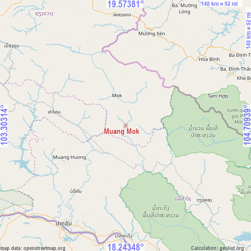
Muang Mok GPS coordinates[2]
18° 54' 35.892" North, 104° 0' 22.536" East
| Map corner | latitude | longitude |
|---|---|---|
| Upper-left | 19.57381°, | 103.30314° |
| Center: | 18.90997°, | 104.00626° |
| Lower-right: | 18.24348°, | 104.70939° |
| Map W x H: | 147.9×147.9 km | = 91.9×91.9mi |
| max Lat: | 21.6808° ⇑44.2% North |
| Muang Mok: | 18.90997° |
| min Lat: | ⇓55.8% South 14.11785° |
| min Long | Muang Mok | max Long |
| 100.4178° | 104.00626° | 107.26667° |
| W 50%⇐ | ⇒50% E |
Elevation
Elevation of Muang Mok is 920 m = 3018 ft, and this is 446.4 m = 1465 ft above average elevation for this country.
| Max E: |
1722 m = 5650 ft | 15.4% |
| Muang Mok | 920 m 3018 ft | |
| Avg. | 473.6 m = 1554 ft | |
Min E: |
83 m = 272 ft | 84.6% |
See also: Laos elevation on elevation.city.
Geographical zone
Muang Mok is located in North Torrid zone (between Equator and Tropic of Cancer). Distance of this Northern Tropic circle is 503.3 km =312.7 mi to North.| Distance of | km | miles | from Muang Mok |
|---|---|---|---|
| North Pole | 7904.5 | 4911.6 | to North |
| Arctic Circle | 5298.6 | 3292.4 | to North |
| Tropic Cancer | 503.3 | 312.7 | to North |
| Equator | 2102.6 | 1306.5 | to South |


Nearby cities:
15 places around Muang Mok: (largest is in red/bold)
• Ban Nahin
77.3 km =48 mi,  163°
163°
• Borikhan
48.5 km =30.1 mi,  217°
217°
• Huameung
138.6 km =86.1 mi,  353°
353°
• Muang Hinboun
159.7 km =99.2 mi, 156°
• Muang Khamkeut
107.8 km =67 mi,  134°
134°
• Muang Phôn-Hông
173.8 km =108 mi,  254°
254°
• Muang Phônsavan
104.5 km =64.9 mi,  305°
305°
• Pakkading
65.1 km =40.5 mi,  181°
181°
• Pakxan
67.9 km =42.2 mi,  212°
212°
• Vangviang
163.9 km =101.8 mi,  270°
270°
• Viangxai
168 km =104.4 mi,  7°
7°
• Viengthong
169.6 km =105.4 mi,  338°
338°
• Viengxay
163.1 km =101.3 mi, 12°
• Xam Nua
167.5 km =104.1 mi,  1°
1°
• Xamtay
127 km =78.9 mi,  24°
24°
Sources, notices
• [Note1] Compared only with cities in Laos existing in our database
• [Src1] Map data: © OpenStreetMap contributors (CC-BY-SA)
• [Src2] Other city data from geonames.org with taken over terms of usage.
• [Src3] Geographical zone / Annual Mean Temperature by Robert A. Rohde @ Wikipedia
