Ban Dônghén geodata
Ban Dônghén (Savannahkhét) is a seat of a second-order administrative division; located in Laos in Asia/Vientiane (GMT+7) time zone. In our database, there are 24 cities with bigger population. Compared to other cities in Laos, 67.3% of cities are located further ↑North; 69.2% of cities are located further ←West and 76.9% of cities have higher elevation than Ban Dônghén. Note1


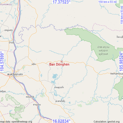
Ban Dônghén GPS coordinates[2]
16° 42' 10.692" North, 105° 16' 55.596" East
| Map corner | latitude | longitude |
|---|---|---|
| Upper-left | 17.37523°, | 104.57899° |
| Center: | 16.70297°, | 105.28211° |
| Lower-right: | 16.02834°, | 105.98524° |
| Map W x H: | 149.8×149.8 km | = 93.1×93.1mi |
| max Lat: | 21.6808° ⇑67.3% North |
| Ban Dônghén: | 16.70297° |
| min Lat: | ⇓32.7% South 14.11785° |
| min Long | Ban Dônghén | max Long |
| 100.4178° | 105.28211° | 107.26667° |
| W 69.2%⇐ | ⇒30.8% E |
Elevation
Elevation of Ban Dônghén is 157 m = 515 ft, and this is 316.6 m = 1039 ft below average elevation for this country.
| Max E: |
1722 m = 5650 ft | 76.9% |
| Avg. | 473.6 m = 1554 ft | |
| Ban Dônghén | 157 m = 515 ft | |
Min E: |
83 m = 272 ft | 23.1% |
See also: Laos elevation on elevation.city.
Geographical zone
Ban Dônghén is located in North Torrid zone (between Equator and Tropic of Cancer). Distance of this Northern Tropic circle is 748.7 km =465.2 mi to North.| Distance of | km | miles | from Ban Dônghén |
|---|---|---|---|
| North Pole | 8149.9 | 5064.1 | to North |
| Arctic Circle | 5544 | 3444.9 | to North |
| Tropic Cancer | 748.7 | 465.2 | to North |
| Equator | 1857.2 | 1154 | to South |


Nearby cities:
15 places around Ban Dônghén: (largest is in red/bold)
• Ban Nahin
205.3 km =127.6 mi,  326°
326°
• Ban Thatèng
183.7 km =114.1 mi,  140°
140°
• Champasak
211.2 km =131.2 mi,  162°
162°
• Lamam
207.9 km =129.2 mi,  133°
133°
• Muang Hinboun
122.2 km =75.9 mi,  323°
323°
• Muang Khamkeut
179.1 km =111.3 mi,  340°
340°
• Muang Phin
81.2 km =50.5 mi,  103°
103°
• Pakkading
226.2 km =140.6 mi, 322°
• Pakse
184.5 km =114.6 mi, 162°
• Pakxong
197.2 km =122.5 mi,  149°
149°
• Phônthong
182.5 km =113.4 mi,  167°
167°
• Salavan
163.5 km =101.6 mi, 132°
• Savannakhet
57.3 km =35.6 mi,  255°
255°
• Sekong
215.6 km =134 mi, 134°
• Thakhèk
92.1 km =57.2 mi, 328°
Sources, notices
• [Note1] Compared only with cities in Laos existing in our database
• [Src1] Map data: © OpenStreetMap contributors (CC-BY-SA)
• [Src2] Other city data from geonames.org with taken over terms of usage.
• [Src3] Geographical zone / Annual Mean Temperature by Robert A. Rohde @ Wikipedia
