Talpe geodata
Talpe (Southern) is a populated place; located in Sri Lanka in Asia/Colombo (GMT+5.5) time zone. With population of 3,000 people, there are 70 cities with bigger population in this country. Compared to other cities in Sri Lanka, 93.4% of cities are located further ↑North; 51.3% of cities are located further ←West and 53.9% of cities have lower elevation than Talpe. Note1
Administrative division(s):
- Level 1: Southern
- Level 2: Galle District
- Level 3: Habaraduwa Division
- Level 4: Wellethota


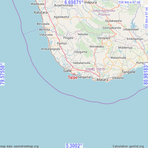
Talpe GPS coordinates[2]
5° 59' 59.64" North, 80° 16' 43.32" East
| Map corner | latitude | longitude |
|---|---|---|
| Upper-left | 6.69871°, | 79.57558° |
| Center: | 5.9999°, | 80.2787° |
| Lower-right: | 5.3002°, | 80.98183° |
| Map W x H: | 155.5×155.5 km | = 96.6×96.6mi |
| max Lat: | 9.81667° ⇑93.4% North |
| Talpe: | 5.9999° |
| min Lat: | ⇓6.6% South 5.92825° |
| min Long | Talpe | max Long |
| 79.79528° | 80.2787° | 81.83472° |
| W 51.3%⇐ | ⇒48.7% E |
Elevation
Elevation of Talpe is 19 m = 62 ft, and this is 138.4 m = 454 ft below average elevation for this country.
| Max E: |
1868 m = 6129 ft | 46.1% |
| Avg. | 157.4 m = 516 ft | |
| Talpe | 19 m = 62 ft | |
Min E: |
1 m = 3 ft | 53.9% |
See also: Sri Lanka elevation on elevation.city.
Geographical zone
Talpe is located in North Torrid zone (between Equator and Tropic of Cancer). Distance of Equator is 667.1 km =414.5 mi to South.| Distance of | km | miles | from Talpe |
|---|---|---|---|
| North Pole | 9339.9 | 5803.5 | to North |
| Arctic Circle | 6734 | 4184.3 | to North |
| Tropic Cancer | 1938.8 | 1204.7 | to North |
| Equator | 667.1 | 414.5 | to South |


Nearby cities:
15 places around Talpe: (largest is in red/bold)
• Ambalangoda
36.1 km =22.4 mi,  316°
316°
• Bentota
56.8 km =35.3 mi,  326°
326°
• Beruwala
62.5 km =38.8 mi, 328°
• Devinuwara
35.2 km =21.9 mi,  103°
103°
• Galle
9.1 km =5.7 mi,  304°
304°
• Hikkaduwa
25.1 km =15.6 mi,  308°
308°
• Horawala Junction
56 km =34.8 mi,  342°
342°
• Kalutara
73.8 km =45.9 mi, 331°
• Koggala
5.7 km =3.5 mi, 102°
• Matara
28.9 km =18 mi, 101°
• Mirissa city
20.7 km =12.9 mi,  106°
106°
• Ratnapura
77.5 km =48.2 mi,  10°
10°
• Tangalle
57.4 km =35.7 mi,  87°
87°
• Unawatuna
3.9 km =2.4 mi, 307°
• Weligama
16.9 km =10.5 mi, 99°
Sources, notices
• [Note1] Compared only with cities in Sri Lanka existing in our database
• [Src1] Map data: © OpenStreetMap contributors (CC-BY-SA)
• [Src2] Other city data from geonames.org with taken over terms of usage.
• [Src3] Geographical zone / Annual Mean Temperature by Robert A. Rohde @ Wikipedia
