Koggala geodata
Koggala (Southern) is a populated place; located in Sri Lanka in Asia/Colombo (GMT+5.5) time zone. With population of 3,000 people, there are 70 cities with bigger population in this country. Compared to other cities in Sri Lanka, 94.7% of cities are located further ↑North; 52.6% of cities are located further ←West and 78.9% of cities have higher elevation than Koggala. Note1
Administrative division(s):
- Level 1: Southern
- Level 2: Galle District
- Level 3: Habaraduwa Division
- Level 4: Koggala


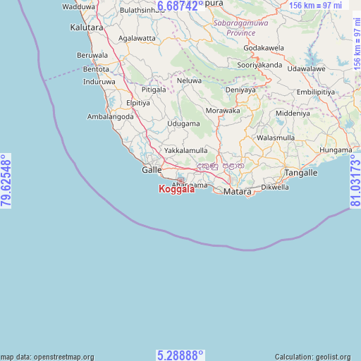
Koggala GPS coordinates[2]
5° 59' 18.96" North, 80° 19' 42.96" East
| Map corner | latitude | longitude |
|---|---|---|
| Upper-left | 6.68742°, | 79.62548° |
| Center: | 5.9886°, | 80.3286° |
| Lower-right: | 5.28888°, | 81.03173° |
| Map W x H: | 155.5×155.5 km | = 96.6×96.6mi |
| max Lat: | 9.81667° ⇑94.7% North |
| Koggala: | 5.9886° |
| min Lat: | ⇓5.3% South 5.92825° |
| min Long | Koggala | max Long |
| 79.79528° | 80.3286° | 81.83472° |
| W 52.6%⇐ | ⇒47.4% E |
Elevation
Elevation of Koggala is 9 m = 30 ft, and this is 148.4 m = 487 ft below average elevation for this country.
| Max E: |
1868 m = 6129 ft | 78.9% |
| Avg. | 157.4 m = 516 ft | |
| Koggala | 9 m = 30 ft | |
Min E: |
1 m = 3 ft | 21.1% |
See also: Sri Lanka elevation on elevation.city.
Geographical zone
Koggala is located in North Torrid zone (between Equator and Tropic of Cancer). Distance of Equator is 665.9 km =413.8 mi to South.| Distance of | km | miles | from Koggala |
|---|---|---|---|
| North Pole | 9341.2 | 5804.4 | to North |
| Arctic Circle | 6735.3 | 4185.1 | to North |
| Tropic Cancer | 1940 | 1205.5 | to North |
| Equator | 665.9 | 413.8 | to South |


Nearby cities:
15 places around Koggala: (largest is in red/bold)
• Ambalangoda
40.9 km =25.4 mi,  312°
312°
• Bentota
61 km =37.9 mi,  322°
322°
• Beruwala
66.6 km =41.4 mi, 324°
• Devinuwara
29.5 km =18.3 mi,  103°
103°
• Galle
14.6 km =9.1 mi,  296°
296°
• Hikkaduwa
30.3 km =18.8 mi, 303°
• Horawala Junction
59.1 km =36.7 mi,  337°
337°
• Kalutara
77.7 km =48.3 mi,  328°
328°
• Matara
23.3 km =14.5 mi, 101°
• Mirissa city
15.1 km =9.4 mi,  108°
108°
• Ratnapura
78 km =48.5 mi,  6°
6°
• Talpe
5.7 km =3.5 mi,  282°
282°
• Tangalle
52 km =32.3 mi,  85°
85°
• Unawatuna
9.4 km =5.8 mi,  292°
292°
• Weligama
11.3 km =7 mi, 97°
Sources, notices
• [Note1] Compared only with cities in Sri Lanka existing in our database
• [Src1] Map data: © OpenStreetMap contributors (CC-BY-SA)
• [Src2] Other city data from geonames.org with taken over terms of usage.
• [Src3] Geographical zone / Annual Mean Temperature by Robert A. Rohde @ Wikipedia
