Varniai geodata
Varniai (Telsiai) is a populated place; located in Lithuania in Europe/Vilnius (GMT+3) time zone. With population of 1,227 people, there are 115 cities with bigger population in this country. Compared to other cities in Lithuania, 76.1% of cities are located further ↓South; 82.8% of cities are located further →East and 90.3% of cities have lower elevation than Varniai. Note1


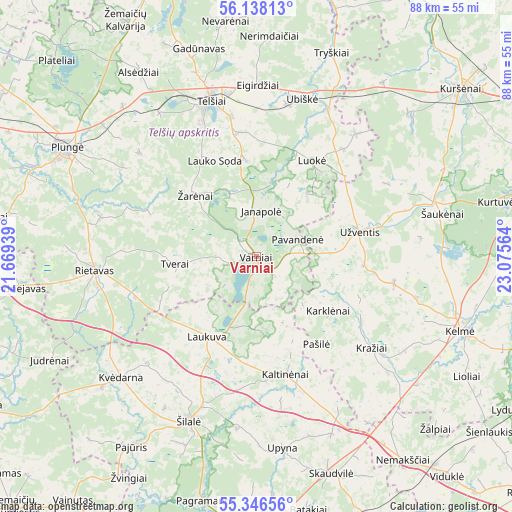
Varniai GPS coordinates[2]
55° 44' 39.66" North, 22° 22' 21.036" East
| Map corner | latitude | longitude |
|---|---|---|
| Upper-left | 56.13813°, | 21.66939° |
| Center: | 55.74435°, | 22.37251° |
| Lower-right: | 55.34656°, | 23.07564° |
| Map W x H: | 88×88 km | = 54.7×54.7mi |
| max Lat: | 56.36149° ⇑23.9% North |
| Varniai: | 55.74435° |
| min Lat: | ⇓76.1% South 54.01573° |
| min Long | Varniai | max Long |
| 20.99651° | 22.37251° | 26.43984° |
| W 17.2%⇐ | ⇒82.8% E |
Elevation
Elevation of Varniai is 160 m = 525 ft, and this is 69.3 m = 227 ft above average elevation for this country.
| Max E: |
204 m = 669 ft | 9.7% |
| Varniai | 160 m 525 ft | |
| Avg. | 90.7 m = 298 ft | |
Min E: |
-1 m = -3 ft | 90.3% |
See also: Lithuania elevation on elevation.city.
Geographical zone
Varniai is located in North temperate zone (between Tropic of Cancer and the Arctic Circle). Distance of this North polar circle is 1203 km =747.5 mi to North.| Distance of | km | miles | from Varniai |
|---|---|---|---|
| North Pole | 3808.9 | 2366.7 | to North |
| Arctic Circle | 1203 | 747.5 | to North |
| Tropic Cancer | 3592.3 | 2232.2 | to South |
| Equator | 6198.2 | 3851.4 | to South |


Nearby cities:
15 places around Varniai: (largest is in red/bold)
• Būgai
39.6 km =24.6 mi,  157°
157°
• Kelmė
37.5 km =23.3 mi,  109°
109°
• Kuršėnai
45.5 km =28.3 mi,  50°
50°
• Plateliai
48.3 km =30 mi,  314°
314°
• Plunge
37.9 km =23.5 mi,  299°
299°
• Rietavas
28.2 km =17.5 mi,  266°
266°
• Seda
50.3 km =31.3 mi,  339°
339°
• Taurage
55 km =34.2 mi,  185°
185°
• Telsiai
27.5 km =17.1 mi, 343°
• Tytuvėnėliai
51.9 km =32.2 mi, 105°
• Užventis
18 km =11.2 mi,  76°
76°
• Venta
53.6 km =33.3 mi,  21°
21°
• Viekšniai
55.4 km =34.4 mi,  9°
9°
• Šilalė
30.6 km =19 mi,  202°
202°
• Žemaičių Naumiestis
60 km =37.3 mi,  224°
224°
Sources, notices
• [Note1] Compared only with cities in Lithuania existing in our database
• [Src1] Map data: © OpenStreetMap contributors (CC-BY-SA)
• [Src2] Other city data from geonames.org with taken over terms of usage.
• [Src3] Geographical zone / Annual Mean Temperature by Robert A. Rohde @ Wikipedia
